Kumotori
| Kumotori | ||
|---|---|---|
|
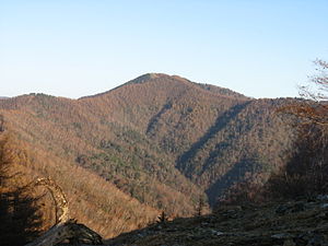
View from Nanatsuishi in the southeast of the Kumotori |
||
| height | 2017.1 m TP | |
| location | Prefectures Yamanashi , Saitama and Tokyo , Japan | |
| Mountains | Okuchichibu Mountains | |
| Coordinates | 35 ° 51 '20 " N , 138 ° 56' 38" E | |
|
|
||
The Kumotori ( Japanese 雲 取 山 , -yama ) is a mountain in the Okuchichibu Mountains on the Japanese main island of Honshū . Its 2017 m high summit lies on the border between the eastern Japanese prefectures of Tokyo , Saitama and Yamanashi , including the communities of Okutama , Chichibu and Tabayama .
The highest point in Tokyo Prefecture and its westernmost point on the main island of Honshu are located on the Kumotori. South-east along the Ishione are the highest mountains in the prefecture, including the 1,927 m high Kokumotoriyama , the "little Kumotori" , immediately south . North of Saitama are Myōhōgatake and Shiraiwa -yama, known together with the Kumotori as Mitsumine-san ( 三 峰山 , "Mitsumine Mountains") above the shrine of the same name . The higher mountains of the Okuchichibu Mountains are to the west.
The area is part of the Chichibu Tama Kai National Park . The forests on the flanks of the Kumotori are also protected as the headwaters of the left Tama tributaries by the prefectural authorities of Tokyo and Yamanashi as suigenrin ( 水源 林 , "spring forests").
The Kumotori belongs to the Nihon Hyakumeizan , the "hundred famous mountains of Japan", which Fukada Kyūya made popular in his 1964 book of the same name.

