Kvaløya
| Kvaløya | ||
|---|---|---|
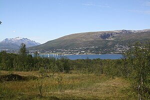
| View from Tromsøya to Kvaløysletta with the bridge over the Sandnessund | ||
| Waters | European Arctic Ocean | |
| Geographical location | 69 ° 38 ′ N , 18 ° 33 ′ E | |
|
|
||
| length | 46.6 km | |
| width | 30.2 km | |
| surface | 735.9 km² | |
| Highest elevation | Store Blåmann 1004 moh. |
|
| Residents | 11,300 (2008) 15 inhabitants / km² |
|
| main place | Kvaløysletta | |
| Location of the island | ||
Kvaløya ( "Whale Island"; Sami: Sállir ) is the fifth largest island in Norway and belongs to Fylke Troms og Finnmark . Parts of the city of Tromsø are located on the island, which is severely divided by several fjords , but most of Kvaløya is rural.
geography
The Kaldfjord in the north and the Ersfjord in the west divide Kvaløya into three parts. On the east side of the island is the Sandnessund, which separates Kvaløya from the much smaller island Tromsøya (with the city center of Tromsø) and the mainland. In the north is the island of Ringvassøy and in the south the mainland and the island of Senja , while in the west, next to some smaller islands, is the open Atlantic.
Most of the island is mountainous. The mountains north of Tromsø mainly consist of tonalites and gneisses that are up to 2.88 billion years old. In addition, the rocks in this area of the island are known to have been exposed to only minor metamorphic influences. At the Ersfjord you can find the so-called Ersfjord granite, which is up to 1.8 billion years old.
traffic
There are two fixed road links from Kvaløya to the mainland. One leads over the Sandnessund Bridge to downtown Tromsø on Tromsøya, from where there is a bridge and tunnel connection to the mainland. The other fixed connection is in the south-east of the island: the Ryatunnel , which is subject to toll , has been connecting Larseng and Balsnes over a length of 2,675 m since September 29, 2011. The tunnel is open to cyclists. The Vikran-Larseng ferry was closed when the tunnel opened. Some other offshore islands such as Sommarøy and Hakøya are connected by bridges.
There are several ferry connections, such. B. from Brensholmen in the southwest to Botnhamn on the neighboring island of Senja (only in summer) and from Belvik on the Kaldfjord to various offshore islands ( Vengsøya , Musvær, Risøy and Sandøya) and to Laukvik, a small village that is also on Kvaløya, but cannot be reached on the street.
The eastern part of the island, directly opposite Tromsø, is integrated into the city's bus network. Otherwise, the villages are connected to the Tromsø regional center via intercity buses.
The nearest airport, Tromsø Airport , is located on the neighboring island of Tromsøya directly on the east side of the island.
politics
The entire island belongs to the municipality of Tromsø, whose administrative center is the city of the same name.
population
A large part of the island's population lives on the east side of the island opposite the city center of Tromsø in the villages of Kvaløysletta and Storelv, which are experiencing strong influx from the core city of Tromsø. However, there are small, scattered settlements all along the coast.


