
Lützelsee
| Lützelsee | ||
|---|---|---|

|
||
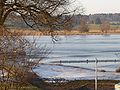
| View over the Lützelsee to the northeast. In the background the Bachtel. | ||
| Geographical location | Canton Zurich | |
| Data | ||
| Coordinates | 700 941 / 235205 | |
|
||
| Altitude above sea level | 500 m above sea level M. | |

Lützelsee is the name for the lake and the hamlet of the same name in the municipality of Hombrechtikon , Canton of Zurich , Switzerland .
The Lützelsee was created as a dead lake . The oldest written mention of the name Lützelsee can be found in a deed of donation to the St. Gallen monastery from the year 745. "Lucikinse" is the spelling for Lützelsee at the time.
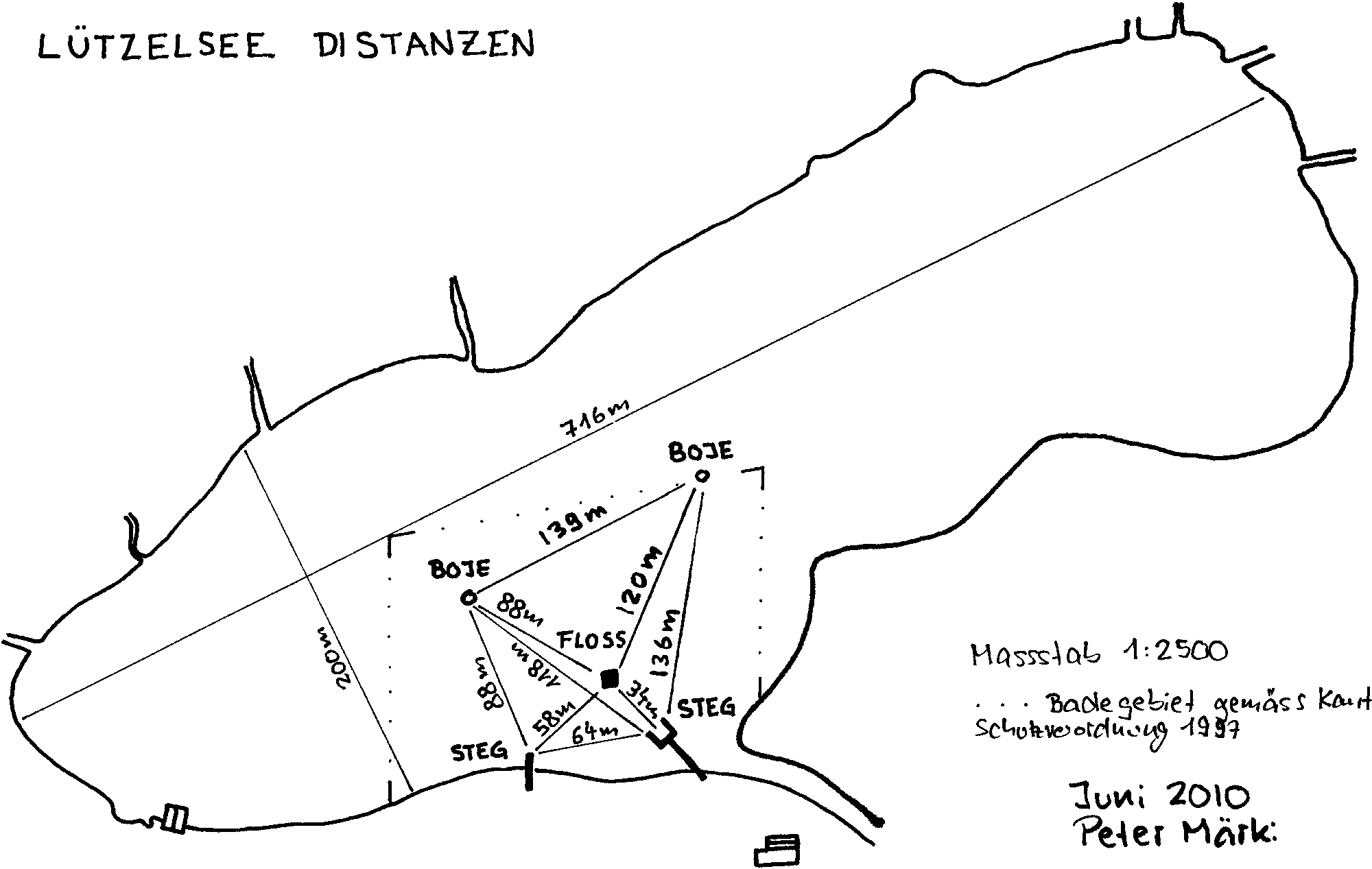
The Lützelsee lies at 500 m above sea level. M. , has an area of 12.8 ha and a catchment area of 570.9 ha. It is located between the hamlets of Lutikon, Hasel and Lützelsee and has been under federal nature and landscape protection since 1983 (Lützelsee-Seeweidsee-Uetziker Riet, property number 1417 ). A circular path leads around the lake. Most of the bank is in a protection zone. Bathing is allowed in a certain area around the bathing establishment.
A special feature are the floating islands on the Lützelsee, which are formed from reed plants that have separated from the shore.
The Lützelsee

The hamlet of Lützelsee

Lake and hamlet


Individual evidence
- ↑ Landscapes and natural monuments of national importance - List of the BLN.
- ↑ Swimming distances Lützelsee
- ^ Lützelsee: Islands