Chivor dam
| Chivor dam - La Esmeralda reservoir - Chivor hydroelectric power station |
|||||||||
|---|---|---|---|---|---|---|---|---|---|
| View of the reservoir | |||||||||
|
|||||||||
|
|
|||||||||
| Coordinates | 4 ° 54 '4 " N , 73 ° 17' 49" W | ||||||||
| Data on the structure | |||||||||
| Lock type: | Rock embankment dam with clay core | ||||||||
| Construction time: | 1969-1976 | ||||||||
| Height above foundation level : | 237 m | ||||||||
| Building volume: | 11,483,000 m³ | ||||||||
| Crown length: | 310 m | ||||||||
| Power plant output: | 1000 MW | ||||||||
| Operator: | AES Chivor & Cia. | ||||||||
| Data on the reservoir | |||||||||
| Altitude (at congestion destination ) | 1200 m | ||||||||
| Water surface | 12.6 km² | ||||||||
| Reservoir length | 18 km | ||||||||
| Reservoir width | 1 km | ||||||||
| Storage space | 758 million m³ | ||||||||
| Catchment area | 2420 km² | ||||||||
| Design flood : | 10,600 m³ / s | ||||||||
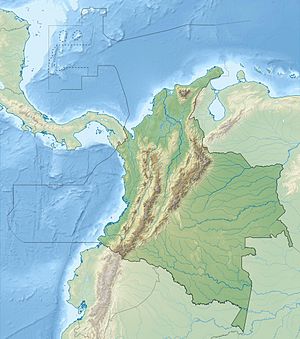
The Chivor Dam (Spanish Represa de Chivor , sometimes also referred to as the "Esmeralda Dam") is a dam on the Río Batá (also Río Garagoa ), a tributary of the Río Guavio , in central Colombia . It is located in the Colombian Eastern Cordillera near the towns of Santa María and Tunja in the Boyacá department, about 90 km east-northeast of Bogotá . It was built between 1970 and 1977. The plant is operated by AES Chivor & Cia., A subsidiary of AES Corp.
dam
The dam consists of a 237 m high rock embankment dam with a clay core. The crown length is 310 m.
Reservoir
The reservoir La Esmeralda (Spanish Embalse La Esmeralda ) is fed by the rivers Río Batá and Río Somondoco . The reservoir also receives feed lines from the Río Tunjita , Río Negro and Río Rucio . The catchment area covers an area of 2420 km². The maximum water area is 12.6 km². The reservoir has a length of about 18 km and is at an altitude of about 1200 m . The storage space is given as 758 million m³. However , this decreases over the years due to sedimentation .
Hydroelectric power plant
The Chivor hydroelectric power station (Spanish: Central hidroeléctrica Chivor ⊙ ) is located on the right bank of the Río Langupá , a tributary of the Río Upía . The water is led from the dam to the power plant further to the east via a pipeline approximately 7 km long. This has eight units. Each has a vertically directed Pelton turbine with an output of 125 MW, a speed of 450 / min and an expansion water volume of 20.25 m³ / s. The power plant uses a drop height of 768 m. Below the power station, the water enters the Río Langupá.
![]() Map with all coordinates: OSM | WikiMap
Map with all coordinates: OSM | WikiMap
Special events
In 2004 there was an unexpected heavy rain event outside of the rainy season. The almost empty reservoir was filled with sediment-rich floods, which also reached the intake structures. Since the hydropower plant was not shut down immediately, the turbines suffered major erosion damage. The system then had to be taken off the grid for 25 days for repair work. The minimum water level in the reservoir for the operation of the power plant has been increased from 1190 m to 1205 m .
See also
- List of the largest dams on earth
- List of the largest reservoirs on earth
- List of power plants in Colombia
- List of dams in the world (Colombia)
Web links
- Colombia - Chivor at international hydropower association (iha)
- Central hidroelectrica chivor at centralhidroelectricachivor.blogspot.com
- Page 9: La Esmeralda Dam (1976) (PDF file; 1.83 MB)
- Reseña Biblioteca Nacional de Colombia Luis Angel Arango
- Aprovechamiento acuícola de embalse en Colombia FAO

