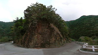
La Farola
| La Farola | |||
|---|---|---|---|
|
|
|||
| Compass direction | south | north | |
| Pass height | 480 m above sea level NN | ||
| region | Guantanamo Province , Cuba | ||
| Valley locations | Cajobabo | Baracoa | |
| expansion | Pass road | ||
| Built | 1965 | ||
| Mountains | Sierra de Purial | ||
| Map (Guantánamo Province) | |||
|
|
|||
| Coordinates | 20 ° 11 '35 " N , 74 ° 28' 4" W | ||
La Farola (Spanish for: "The light mast", "The street lamp") is a 53 km long pass road in the "Sierra de Purial" in the Cuban province of Guantánamo in the east of the country. It forms the end of the Carretera Central road, which crosses the whole country, and connects the village of Cajobabo on the south coast with the city of Baracoa on the north coast.
Route
The two-lane road begins on the "Costa del Sur" (Spanish for: "south coast") in the small town of Cajobabo, where José Martí and Máximo Gómez began their war of independence against Spain in 1895 .
The pass road meanders through the tropical rainforest of the "Sierra de Purial". The further inland it leads, the thicker the vegetation becomes. The steepest and most winding section is around 40 km long. Stopping bays have been built at several points from which one can enjoy breathtaking views over the rainforests, pine forests, banana plantations and rivers in the area. The highest point of the route is the "Alto de Cotillo" with a small café and an observation tower. Traditionally, the Cubans offer fruit, coffee and cocoa for sale at all vantage points along the street.
Once on the north coast, La Farola ends in the city of Baracoa, which was once the first capital of Cuba.
history
After the revolution under Fidel Castro , La Farola was one of the first major projects. Between 1964 and 1965, the revolutionaries had the pass road built to complement the Carretera Central road. The planning was done by Maximiliano Isoba García; the chief engineer was Luis Pérez Cid. For the first time since its completion, it has connected Baracoa with the rest of Cuba by land. Before that, the city could only be reached by sea or by plane. Built from the stones of the "Sierra de Purial", the demanding route became one of the greatest technical achievements of modern Cuba.
In order to avoid complex bridges and large earth movements, the road was instead adapted to the geology with many curves, the route profile repeatedly shows local culminations. The mountain-side slopes, which are often unstable, occasionally muddy the road, or stones fall onto the road.
The name "La Farola" (Spanish for: "The light pole", "The street lamp") is derived from the fact that some road sections appear like rays of light in the dark rainforest.
Between 1982 and 1989, La Farola hosted the Premio Internacional La Farola cycling race . Due to economic difficulties during the special period in peacetime , the tour was canceled after the eighth edition in 1989 and has not resumed since then.
Individual evidence
- ↑ reisen-kuba.net: La Farola pass road through the rainforest. Retrieved August 21, 2018 .
- ↑ Cubaworld.de: Cuba's sights - La Farola. Retrieved August 21, 2018 .
- ↑ Wolfgang Ziegler: Travel Guide "Cuba" . Ed .: Michael Müller Verlag. ISBN 978-3-95654-345-6 .


