La Grange Bay
| La Grange Bay | ||
|---|---|---|
| Waters | Indian Ocean | |
| Land mass | Australia | |
| Geographical location | 18 ° 38 '40 " S , 121 ° 42' 3" E | |
|
|
||
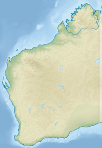
The Lagrange Bay , named after the mathematician Joseph-Louis Lagrange , is a bay in Australia , which is about 200km south of Broome and 400 km north of Port Hedland in Western Australia is located.
The tidal range in this bay is about ten meters and the ebb tides expose kilometers of silt fields and rocky cliffs. Numerous mussels live in the bay, such as the clam , corals and huge mangrove swamps can be found there. The mussels are collected and used in handicrafts. Countless fish live in the water, such as the highly poisonous blue-ringed octopus , turtles , dugongs (manatees), smaller dolphins and flying fish . The bay is frequented by many birds such as brolga and ducks .
The bay is inhabited by several of the Aboriginal tribes such as the Karajarri, Nyangumarta, Juwaliny, Mangala, and Yulparija, who own the land from the south from Roebuck Bay to Port Hedland and hundreds of square kilometers inland. As part of the Community Development Employment Program (CDEP) to operate the Bidyadanga Aboriginal Community Inc . In the bay is the Aboriginal settlement of Bidyadanga with over 100 houses and over 600 inhabitants in three districts. There is also the Catholic Aboriginal mission station La Grange Mission in the bay .
In La Grange Bay, three European settlers were killed by Aborigines in 1865, either with spears or clubs. Numerous Aborigines were subsequently massacred by members of the expedition in clashes that are often referred to as the La Grange massacre .
Web links
- Information on La Grange Bay . Retrieved June 6, 2009
Individual evidence
- ^ Johann Jakob Egli : Nomina geographica. Language and factual explanation of 42,000 geographical names of all regions of the world. Friedrich Brandstetter, 2nd ed. Leipzig 1893, p. 521
