Lac Massawippi
| Lac Massawippi | ||
|---|---|---|

|
||
| Lakeshore at North Hatley | ||
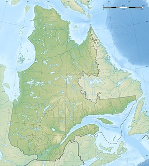
| Geographical location | Estrie in Québec (Canada) | |
| Tributaries | Rivière Tomifobia | |
| Drain | Rivière Massawippi | |
| Location close to the shore | Sherbrooke | |
| Data | ||
| Coordinates | 45 ° 13 ′ N , 72 ° 0 ′ W | |
|
|
||
| Altitude above sea level | 166 m | |
| surface | 15 km² | |
| length | 14.2 km | |
| width | 1.9 km | |
| Maximum depth | 75 m | |
| Catchment area | 586 km² | |

|
||
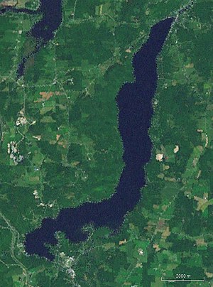
| Satellite image of Lac Massawippi | ||
The Lac Massawippi is a lake in the south of the Canadian province of Quebec in the MRC Memphrémagog .
The 14.2 km long and 1.9 km wide lake is located about 20 km south of Sherbrooke and 20 km north of the state border with the United States . Ayer's Cliff is located at the southern end of the lake and North Hatley at the northern end of the lake . Other parishes that border the lake are Sainte-Catherine-de-Hatley , Ayer's Cliff, Hatley and Hatley-Partie-Ouest . The Rivière Tomifobia, which flows into the southern end of the lake, is an important tributary . The Rivière Massawippi drains the lake at the northern end to the Rivière Saint-François . The catchment area of the lake covers 586 km². The mean discharge of the Rivière Massawippi at the outflow from the lake is 10 m³ / s.
The Lac Massawippi and its surroundings form a recreational area.
Web links
Individual evidence
- ↑ a b c Commission de toponymie du Québec: Lac Massawippi
- ↑ Water Survey of Canada: Station 02OE019 ( page no longer available , search in web archives ) Info: The link was automatically marked as defective. Please check the link according to the instructions and then remove this notice.
