Lac Opiscotéo
| Lac Opiscotéo | ||
|---|---|---|
| Geographical location | Côte-Nord in Québec (Canada) | |
| Tributaries | Rivière Caniapiscau | |
| Drain | Rivière Caniapiscau | |
| Data | ||
| Coordinates | 53 ° 10 ′ N , 68 ° 10 ′ W | |
|
|
||
| Altitude above sea level | 607 m | |
| length | 35 km | |
| width | 22 km | |
The Opiscoteo Lake is a lake in the Administrative Region Côte-Nord of the Canadian province of Quebec .
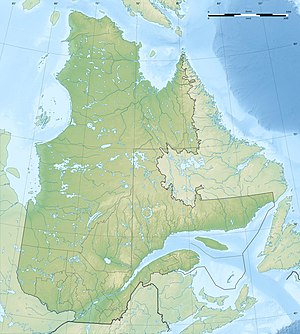
Lac Opiscotéo is located in central Labrador 75 km northwest of Fermont . The lake is in the area of the Canadian Shield at an altitude of 607 m . Lac Opiscotéo is located on the upper reaches of the Rivière Caniapiscau not far from its headwaters . The Rivière Caniapiscau meets the lake coming from the south and leaves it on its northwestern bank to the neighboring lake Lac Raimbault . The Lac Opiscotéo is interspersed with many small islands. It has a length of 35 km and a width of about 22 km.
The name of the lake is derived from the Montagnais word for “where it thundered”.
