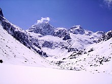
Lac de Gaube
| Lac de Gaube | ||
|---|---|---|

|
||
| Lac de Gaube | ||
| Geographical location | Pyrenees | |
| Location close to the shore | Cauterets | |
| Data | ||
| Coordinates | 42 ° 49 '54 " N , 0 ° 8' 23" W | |
|
|
||
| Altitude above sea level | 1725 m | |
| surface | 19 ha | |
| Maximum depth | 40 m | |
The Lac de Gaube is one of numerous mountain lakes on the French side of the Pyrenees . It is located in the Hautes-Pyrénées department ( Occitania region ) and is about three hours' walk from Cauterets . It lies at an altitude of 1725 m and is fed by the surrounding, mostly underground, tributaries of the meltwater from the glaciers of the Vignemale massif. From there, there are relatively seldom ascents to the Pic de Vignemale . The lake gained fame in its depiction by Stanislaus von Kalckreuth (1855).
Web links
Commons : Lac de Gaube - Collection of images, videos and audio files

