Laughing La
| Laughing La | |||
|---|---|---|---|
|
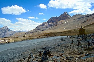
View from Lachulung La to the south |
|||
| Compass direction | North | south | |
| Pass height | 5059 m | ||
| Union Territory | Ladakh ( India ) | ||
| Watershed | Tozay Chu | Tsarap Chu | |
| Valley locations | Sarchu | Pang | |
| expansion | Pass road | ||
| Mountains | Zanskar chain | ||
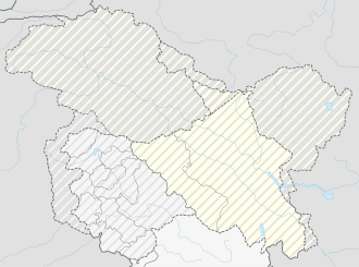
| map | |||
|
|
|||
| Coordinates | 33 ° 6 '14 " N , 77 ° 37' 46" E | ||
The Lachulung La (also Lāchālūng La or "Lungalacha La") is located in the Ladakh region in the Indian Union Territory of Ladakh. It separates the valleys of the Tsarap and the Tozay Chu , both of which flow over the Zanskar to the Indus .
The pass on the Manali-Leh Highway is only 8 kilometers from Nakee La ; to Pang , 24 kilometers to the north, the road mostly follows the narrow gorge of the Lachulung Lungpa . Buses and shared taxis usually stop here for a few minutes, but the view of the surrounding, nameless mountains is rather disappointing because of the small height difference.
literature
- Ladakh Kashmir Manali - The Essential Guide Partha S. Banerjee, Kolkata: Milestone Books 2010, ISBN 978-81-903270-2-2
Individual evidence
- ↑ GeoNames : Lāchālūng La . Retrieved July 16, 2012.

