
Lake Campotosto
| Lake Campotosto | ||
|---|---|---|

|
||
| The Lago di Campotosto with the Gran Sasso massif in the background | ||
| Geographical location | Abruzzo , Italy | |
| Tributaries | Rio Fucio | |
| Drain | Rio Fucio → Zingano → Vomano | |
| Places on the shore | Campotosto , Capitignano | |
| Location close to the shore | L'Aquila | |
| Data | ||
| Coordinates | 42 ° 32 '1 " N , 13 ° 23' 2" E | |
|
||
| Altitude above sea level | 1313 m slm | |
| surface | 14 km² | |
| Maximum depth | 35 m | |
| Catchment area | 47.5 km² | |

The Lago di Campotosto is a reservoir in the Italian region of Abruzzo . It is located at an altitude of 1313 meters within the Gran Sasso and Monti della Laga National Park and, with an area of 14 km², is one of the largest artificial lakes in Europe.
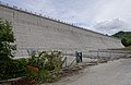
The dam of the lake

Partly frozen over in winter


Web links
Commons : Lago di Campotosto - Collection of images, videos and audio files