Laguna Blanca (lake, Chile)
| Laguna Blanca | ||
|---|---|---|

|
||
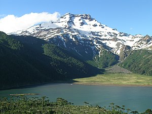
| The Laguna Blanca at the foot of the Tolhuaca | ||
| Geographical location | Región de la Araucanía , Chile | |
| Drain | none | |
| Location close to the shore | Curacautín | |
| Data | ||
| Coordinates | 38 ° 21 '28 " S , 71 ° 38' 36" W | |
|
|
||
| Altitude above sea level | 1200 m | |
| surface | 65 ha | |
| Maximum depth | 12 m | |
The Laguna Blanca is a mountain lake in southern Chile, which is located at 1,200 meters above sea level at the foot of the Tolhuaca volcano , from whose glaciers it is fed. It is 65 hectares in size and 12 meters deep at the deepest point. Its peculiarity is that it has no above-ground drain. It was dammed up by a lava flow from the adjacent Lonquimay volcano . The Laguna Blanca is privately owned, as according to Chilean law it is not navigable and therefore not public.
location
The Laguna Blanca is located 26 km northeast of the municipality of Curacautín in the Región de la Araucanía in Chile. It is also located in the UNESCO Araucarias Biosphere Reserve and in the area of the planned UNESCO Geopark Kütralcura.
Flora Fauna
The Chilean araucaria is widespread around the lagoon. There are large trout stocks in the lagoon and a condom nest on its flank.
