Lake Carey (Western Australia)
| Lake Carey | ||
|---|---|---|

|
||
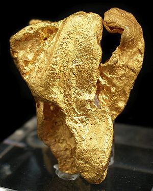
| A gold nugget from the Lake Carey area (77 grams) | ||
| Geographical location | Western Australia | |
| Location close to the shore | Laverton | |
| Data | ||
| Coordinates | 29 ° 5 '4 " S , 122 ° 18' 56" O | |
|
|
||
| surface | 750 km² | |
| Catchment area | 9000 km² | |
The Lake Carey is a salt lake , 30 kilometers south of Laverton in Western Australia in the zone Laverton Tectonic is. There are several gold mines in the immediate vicinity of the lake.
Lake Carey is one of the numerous salt lakes that formed from the prehistoric Carey River system. The so-called Carey Paleoriver was one of five ancient and parallel drainage systems that may have drained into the Great Australian Bight . The landscape of the salt lakes in the Wiluna and Laverton area is called Salinaland.
The surface of the lake is about 750 km², although the information varies greatly. There are numerous islands made up of a plaster crust . Its catchment area covers 9000 km².
The lake has been important for gold mining in the region since the 1890s. On the east side of the lake is the Sunrise Dam gold mine , wholly owned by Anglogold Ashanti . It is estimated that 2.3 million tons of gold there has a gold content of 4.6 grams per ton. The company Midas Resources continues to operate south of a gold project that includes the Fortitude gold deposit with an estimated volume of 356,000 oz gold. To the northwest of the salt lake is the Granny Smith gold mine , which Barrick Gold has operated since 2008 .
The Aborigines of Wangkathaa have a close relationship to this field and to the salt lake.
Web links
- A gold Prospectors description of Lake Carey (English)
- MSN map of Lake Carey (English)
Individual evidence
- ↑ a b c actis.com.au (PDF; 828 kB): Mark Coleman: Salt Lakes in the Western Australian Landscape with Specific Reference to the Yilgarn and Goldfields Region. Pp. 17–21, in English, accessed on May 27, 2013
- ↑ crcleme.org.au (PDF; 5.2 MB): HJ Gray, AF Britt: Sunrise Dam Dold Deposit, Eastern Goldfields, WA , in English, accessed on May 27, 2013
- ↑ midas resources.com : Midas Resources Limited , accessed May 27, 2013
- ↑ aija.org.au ( Memento of the original from February 4, 2012 in the Internet Archive ) Info: The archive link was automatically inserted and not yet checked. Please check the original and archive link according to the instructions and then remove this notice. (PDF; 205 kB): Chapter Four: Aboriginal People in Western Australia , in English, accessed on May 27, 2013
