Lake Cethena
| Lake Cethena | |||||||||
|---|---|---|---|---|---|---|---|---|---|
|
|||||||||
|
|
|||||||||
| Coordinates | 41 ° 31 '38 " S , 146 ° 7' 34" E | ||||||||
| Data on the structure | |||||||||
| Data on the reservoir | |||||||||
| Altitude (at congestion destination ) | 222 m | ||||||||
| Water surface | 5.5 km² | ||||||||
| Reservoir length | 13.5 km | ||||||||
| Reservoir width | 1.5 km | ||||||||
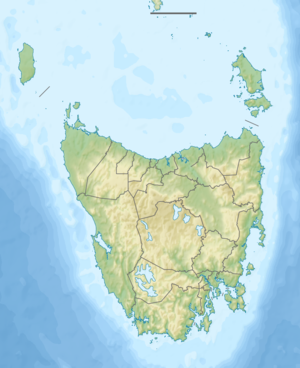
The Lake Cethena is a dam in the north of the Australian state of Tasmania .
It is located on the central reaches of the Forth River north of the Cradle Mountain Lake St. Clair National Park . At its southern end the Dove River flows into the River Forth, further north the Bull Creek .
The Lorinna settlement is on its eastern bank .
Sources and web links
- Lake Cethana - TAS . ExplorOz.com
- Map of Lake Cethena, TAS . Bonzle.com
- Steve Parish: Australian Touring Atlas . Steve Parish Publishing, Archerfield QLD 2007. ISBN 978-1-74193-232-4 . P. 60
