Long stone (Flonheim)
| Long stone | ||
|---|---|---|
|
|
||
| Coordinates | 49 ° 47 '25.2 " N , 8 ° 3' 41.3" E | |
| place | Bornheim , Rhineland-Palatinate , Germany | |
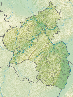
The Lange Stein is a menhir originally from Flonheim in the Alzey-Worms district in Rhineland-Palatinate , which today stands in the area of the neighboring municipality of Bornheim .
Location and description
The menhir originally stood on an old road from Armsheim via Lonsheim to Alzey , where it marked the border between the districts of Flonheim and Bornheim. In the 1970s or 1980s it was moved around 500 m to the southwest to its current location on a field northeast of Flonheim and north of Bornheim and is now on Bornheim territory. He lay there for some time, but was later raised again. The long stone could originally have served as a crown for a burial mound that no longer exists today, as is also assumed for neighboring menhirs: The destroyed Haugstein , whose name derives from "haugr" ("hill"), was just 500 m north of the original location. ) should derive. The same applies to several preserved menhirs such as the menhirs from Armsheim 1.5 km to the north and the two menhirs 1.8 km to the north, Der Dicke Stein and Spitzer Stein .
The long stone is made of white sand-lime brick . It has a height of 150 cm, a width of 80 cm and a depth of 45 cm. It is irregularly columnar and tapers upwards in a wedge shape. The stone has a base with a triangular cross-section and ends in an oblique tip. About two thirds of its height, it has a natural constriction, which gives the upper end of the stone the appearance of a bird's head stretched upwards.
Rare cult and border monument from prehistoric times in the processing area.
literature
- Georg Durst: The monoliths of the province of Rheinhessen. In: Mainz magazine. Volume 33, 1928, p. 21.
- Otto Gödel: Menhirs, witnesses of cult, border and legal customs in the Palatinate, Rheinhessen and the Saar area. Speyer 1987, pp. 74ff.
- Johannes Groht: Menhirs in Germany. State Office for Monument Preservation and Archeology Saxony-Anhalt, Halle (Saale) 2013, ISBN 978-3-943904-18-5 , pp. 268, 330.
- Horst Kirchner: The menhirs in Central Europe and the menhir thought. Academy of Sciences and Literature, Treatises of the Humanities and Social Sciences Class, Born 1955, No. 9, Wiesbaden 1955, p. 160.
- Detert Zylmann: The riddle of the menhirs. Probst, Mainz-Kostheim 2003, ISBN 978-3-936326-07-9 , p. 103.
- Monument topography Federal Republic of Germany: Cultural monuments in Rhineland-Palatinate Volume 20.1: District of Alzey-Worms . Verbandsgemeinde Alzey-Land . Published on behalf of the Ministry of Education, Science, Further Education and Culture by the General Directorate for Cultural Heritage Rhineland-Palatinate Directorate State Monument Preservation. Edited by Michael Huyer and Dieter Krienke. Wernersche Verlagsgesellschaft : Worms 2013. ISBN 978-3-88462-327-5 ; P. 100
Web links
Individual evidence
- ^ Johannes Groht: Menhirs in Germany. P. 330.
