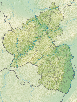
Long stone (Rittersheim)
| Long stone | ||
|---|---|---|
|
|
||
| Coordinates | 49 ° 40 '26.4 " N , 8 ° 3' 2.2" E | |
| place | Rittersheim , Donnersbergkreis , Rhineland-Palatinate , Germany | |
The long stone is a possible menhir near Rittersheim in the Donnersbergkreis in Rhineland-Palatinate .
Location and description
The long stone is located northwest of Rittersheim on a field below the highest point of an elevation. There it marks the border between Rittersheim and Bischheim . About 700 m to the north there was originally another stone in the “Am Galgen” corridor, which was called “Hunkelstein” in 1533 and probably served as a place of justice .
The stone consists of porphyry conglomerate , the place of origin of which could be identified as an occurrence 10 km away on the Donnersberg . It has a height of 145 cm, a width of 30 cm and a depth of 25 cm. It is pillar-shaped, has a rectangular, almost square cross-section and ends in a rounded tip. An R and a B for Rittersheim and Bischheim are carved on two sides. According to Otto Gödel, today's shape goes back to a strong processing of the prehistoric stone in the Middle Ages, Ernst Christmann, however, did not see a menhir in it, but a boundary stone that was only created in the Middle Ages . In 1979 it lay broken on the ground, but in 1987 at the latest it was put back together with cement and erected.
literature
- Ernst Christmann: Menhirs and menhirs in the Palatinate. Speyer n.d. (1947), pp. 30-31.
- Otto Gödel: Menhirs, witnesses of cult, border and legal customs in the Palatinate, Rheinhessen and the Saar area. Speyer 1987, pp. 140ff.
- Johannes Groht : Menhirs in Germany. State Office for Monument Preservation and Archeology Saxony-Anhalt, Halle (Saale) 2013, ISBN 978-3-943904-18-5 , p. 315, 343.
Web links
Individual evidence
- ^ Johannes Groht: Menhirs in Germany. P. 343.
