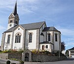
Leudelange
| coat of arms | map |
|---|---|

|

|
| Basic data | |
| State : |
|
| Coordinates : | 49 ° 34 ' N , 6 ° 4' E |
| Canton : | Esch on the Alzette |
| Residents : | 2668 (January 1, 2019) |
| Area : | 13.6 km² |
| Population density : | 196.6 inhabitants / km² |
| Postal code : | 3205-3377 |
| Municipality number: | 0207 |
| Website: | www.leudelange.lu |
| politics | |
| Mayor: | Diane Bisenius-Feipel |
| Elective system : | Majority vote |
Leudelingen ( Luxembourgish Leideleng , French Leudelange ) is a municipality in the Grand Duchy of Luxembourg and belongs to the canton of Esch an der Alzette .
history
In 1856, Leudelingen was separated from Reckingen / Mess and the community of Leudelingen was founded. In 1900 Leudelange received a train station on the Luxembourg- Pétange railway line. 1903 the place had 694 inhabitants, in 2007 2000 inhabitants.
The municipality of Leudelingen consists of the following localities:
- Leudelange
- Schlewenhof
- Leudelange Gare
Individual evidence
Web links
Commons : Leudelange - Collection of images, videos and audio files
