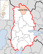
Ljusnarsberg (municipality)
| Ljusnarsberg municipality | |||||
|---|---|---|---|---|---|
|
|||||
| State : | Sweden | ||||
| Province (län): | Örebro län | ||||
| Historical Province (landskap): | Vastmanland | ||||
| Main place: | Kopparberg | ||||
| SCB code: | 1864 | ||||
| Residents : | 4771 (December 31, 2019) | ||||
| Area : | 631.1 km² (January 1, 2016) | ||||
| Population density : | 7.6 inhabitants / km² | ||||
| Website : | www.ljusnarsberg.se | ||||
| List of municipalities in Sweden | |||||
Coordinates: 59 ° 53 ' N , 14 ° 59' O Ljusnarsberg is a municipality ( Swedish kommun ) in the Swedish province Orebro Lan and the historical province Västmanland . The main town of the municipality is Kopparberg .
geography
The community is characterized by ore-bearing volcanic rock. Granite can also be found in the east of the municipality . This rock bed, which is often torn open, is covered by a moraine on which coniferous forest grows. There are often moors in the valleys. In many places the forest was cleared for mining, but in the eastern part of the municipality there is still a contiguous forest area with many lakes. The Nittälven river has washed ashore in its valley. There rapids and zones in which the river meanders alternate.
history
Some residential areas are known from the Stone Age . Today's buildings originated in the 17th century in connection with the emerging mining industry and reached their heyday in the 18th century with a large number of pits and workshops. The associated parish received a church in 1635 and was characterized by the fact that the priests spoke Finnish . Even at the beginning of the 20th century, mining was the main source of income and there was a large ironworks in Bångbro , which was closed in 1987.
From 1960 the pits were gradually closed. The last mine in the main town was closed in 1975 and in 1978 the last iron ore mine in the municipality ended. Until 1989 there was still a mine in which Scheelite was mined, but this long-standing industrial tradition came to an end when it was closed.
economy
After all mining pits were closed, a fiber products company became the largest employer in the community. Furthermore, the economy of the community is characterized by a brewery, many small businesses and the public sector. The disease rate and unemployment are particularly high due to mining and its decline.
Attractions
The church of the parish of Ljusnarsberg was named the most beautiful church in Sweden by the weekly newspaper " Året Runt ". The wooden church in Hörken is also worth seeing. The miners' houses have been preserved in some parts of the community. The Södra Finnfall farm is worth mentioning, which is 10 km east of Kopparberg. Various houses from the 17th century can be seen here.
It is also worth making a detour to the Östra Born hut , which is located near the village of Ställdalen . Outside of Kopparberg there is a "pit park" where the technology used has been collected in one place.
places
The following places are localities ( tatorter ):
Web links
- Official website (Swedish)
Individual evidence
- ↑ Folkmängd i riket, län och kommuner December 31, 2019 at Statistiska centralbyrån
- ↑ Kommunarealer January 1, 2016 at Statistiska centralbyrån (including all inland waters)

