Loch Eriboll
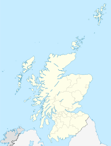
Coordinates: 58 ° 31 ′ 0 ″ N , 4 ° 41 ′ 0 ″ W.
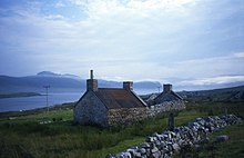
The Loch Eriboll ( gäl . : Loch Euraboil ) is a 16 km long and 2–3 km wide inlet ( fjord ) in the county of Sutherland ( Highlands ) on the Scottish north coast. It was used as a deep sea anchorage for centuries as it is protected from the stormy seas between Cape Wrath and the Pentland Firth . Its name is derived from the village of Eriboll on its eastern coast. Nearby were the Bronze and Iron Age remains found; including the basement of Portnancon and the well-preserved Atlantic round house Tigh na Fiarnain on the hills of its western coast.
history
Operation Tungsten
In February 1944, the area became the scene of extensive training missions in the run-up to Operation Tungsten , which involved an attack on the German battleship Tirpitz . As the landscape of Loch Eriboll was very similar to the Tirpitz base of operations in the Kåfjord in Norway at that time, the aircraft crews - operating from the Hatston Air Force Base - handled the area here.
Submarine assembly point
At the end of the Second World War, the German submarines in the North Atlantic were asked to call at Loch Eriboll in order to surrender to the Allies there. Between May 10 and May 25, 1945, at least 33 submarines were found here, most of whose armaments were dismantled on the spot and sunk in the fjord. The boats themselves were sunk in Operation Deadlight in the Atlantic north of Ireland .
Web links
- Panorama of Loch Eriboll (QuickTime)
- Auslan Cramb: Mass surrender of Nazi U-boats documented in new book. In: The Telegraph . March 20, 2010, accessed August 14, 2016 .
Individual evidence
- ^ Patrick Bishop: Target Tirpitz, p. 297 . London: Harper Press, 2012, ISBN 978-0-00-743119-9 .


