Loch Ewe
| Loch Ewe | ||
|---|---|---|
|
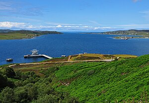
View over Loch Ewe |
||
| Waters | The Minch | |
| Land mass | Great Britain (island) | |
| Geographical location | 57 ° 49 ′ N , 5 ° 38 ′ W | |
|
|
||
| width | approx. 6 km | |
| depth | approx. 12 km | |
| Greatest water depth | 40 m | |
| Medium water depth | 15 m | |
| Islands | Isle of Ewe | |
| Tributaries | River Ewe | |
Loch Ewe is a bay in the Wester Ross region of the Northwest Highlands in northwest Scotland . At the southeast end, the River Ewe flows into the bay, which itself flows into The Minch , part of the North Atlantic off the Scottish west coast. It has an average depth of 15 m and is up to 40 m deep. In it is the Isle of Ewe .
history
During the Second World War, the bay was the starting point for several northern sea convoys , such as the convoy trains PQ 13 , PQ 18 , JW 51B , JW 53 , JW 55B , JW 56A , JW 56B , JW 57 , JW 58 , JW 59 and others. The EN convoys and the Northern Sea convoys QP 14 , QP 15 , RA 52 , RA 53 , RA 57 , RA 64 , RA 59A , RA 62 and others also ended here .
literature
- Richard Woodman: Arctic Convoys 1941-1945 . John Murray, London 2004, ISBN 978-0-7195-6617-2 (The compelling Second World War merchant navy story set in the icy Barents Sea, English).
Web links
Commons : Loch Ewe - collection of images, videos and audio files

