Loch an Daimh (Perth and Kinross)
| Hole at daimh | ||
|---|---|---|

|
||
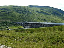
| Loch an Daimh photographed from the north | ||
| Geographical location | Perth and Kinross , Scotland | |
| Tributaries | Eas daimh | |
| Drain | Allt Conait → River Lyon → Tay | |
| Data | ||
| Coordinates | 56 ° 35 '17 " N , 4 ° 27' 57" W | |
|
|
||
| Altitude above sea level | 430 m ASL | |
| length | 5 km | |
| width | 400 m | |
Loch an Daimh is a reservoir in Scotland . It is located in a side valley of Glen Lyon in the Council Area Perth and Kinross . Loch an Daimh is about five kilometers long and on average about 400 m wide. It has a surface of around 2 km². The lake visible today was created by damming the Allt Conait and combines the two former natural lakes Loch an Daimh and Loch Giorra into one body of water.
The banks of Loch an Daimh appear exclusively as grassland and are completely uninhabited. Only the dam on the east bank - the Giorra Dam - and about half of the north bank are accessible by a road from Glen Lyon.
North of Loch an Daimh is the 932 m high Meall Buidhe , south of the 960 m high Stuchd an Lochain . The area around the lake is a popular hiking area.

