Logan City
| City of Logan | |
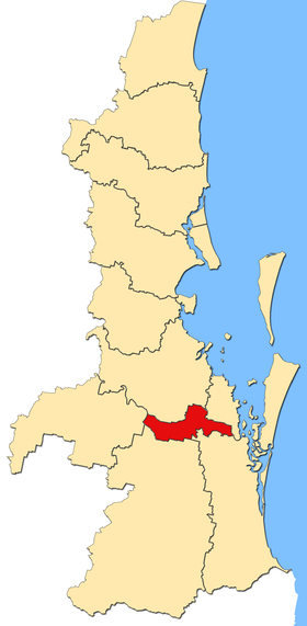
 Location of Logan City in Queensland |
|
| structure | |
| State : |
|
| State : |
|
| Administrative headquarters: | Logan Central |
| Dates and numbers | |
| Area : | 958.1 km² |
| Residents : | 303,386 (2016) |
| Population density : | 317 inhabitants per km² |
| Wards : | 12 |
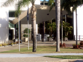
 Logan City Council headquarters |
|
Coordinates: 27 ° 38 ′ S , 153 ° 6 ′ E The City of Logan is a local government area (LGA) in the Australian state of Queensland . The area is 958 km² and has about 303,000 inhabitants. The LGA overlaps with the city of Logan .
geography
Logan is located in the southeast of the state and borders the capital Brisbane to the north .
The administrative headquarters of the LGA is in the district of Logan Central, in which about 5900 inhabitants live. Other neighborhoods include Bahrs Scrub, Bannockburn, Beenleigh, Belivah, Berrinba, Bethania , Boronia Heights, Browns Plains, Buccan, Carbrook, Cedar Creek, Cedar Grove, Cedar Vale, Chambers Flat, Cornubia, Crestmead, Daisy Hill, Eagleby, Edens Landing, Forestdale, Greenbank, Heritage Park, Hillcrest, Holmview, Jimboomba, Kagaru, Kingston, Logan Central, Logan Reserve, Logan Village, Loganholme, Loganlea, Lyons, Marsden, Meadowbrook, Mount Warren Park, Mundoolun, Munruben, New Beith, North Maclean, Park Ridge, Park Ridge South, Priestdale, Regents Park, Rochedale South, Shailer Park, Slacks Creek, South Maclean, Springwood , Stockleigh, Tamborine, Tanah Merah, Underwood, Undullah, Veresdale, Veresdale Scrub, Waterford, Waterford West, Windaroo, Wolffdene , Woodhill, Woodridge and Yarrabilba.
history
Logan Shire was formed in 1979 from parts of the Albert and Beaudesert Shire and two years later it was renamed Logan City. In 2008, the LGA was expanded to include parts of the Gold Coast City and other parts of the Beaudesert Shire as part of the major reform.
administration
The Logan City Council has 13 members. Twelve councilors are elected by the residents of the twelve divisions (constituencies). The council chairman and mayor (mayor) is also elected by all residents of the city.
Web links
- Official site of the Logan City Council (English)
- Queensland Places: Logan City (English)
Individual evidence
- ↑ a b Australian Bureau of Statistics : Logan (C) ( English ) In: 2016 Census QuickStats . June 27, 2017. Retrieved May 14, 2020.
- ↑ Australian Bureau of Statistics : Logan Central ( English ) In: 2016 Census QuickStats . June 27, 2017. Retrieved May 14, 2020.