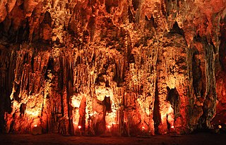
Loltún cave
| Loltún cave
|
||
|---|---|---|
| Location: | Yucatan Peninsula , Mexico | |
|
Geographic location: |
20 ° 15 '10 " N , 89 ° 27' 23" W | |
|
|
||
| Type: | Stalactite cave | |
| Length of the show cave area: |
1000 meters | |
The Loltún Cave is a cave about 110 km southwest of the city of Merida , in the Puuc region , on the Yucatán Peninsula in Mexico .
The name of the cave is made up of the Mayan words "Lol" ("flower") and "Tun" ("stone"). The path through the cave is about a kilometer long.
history
Ceramic dating shows that the cave was used by people from 1000 BC. The last traces come from the caste war of 1847. During the war, the cave was used as a hiding place for the Maya population. Pleistocene bones were found in the cave .
Attractions
In the cave you can see a cult site of the Olmecs , marked by a stone head in the Olmec style and symbols. You can also see paintings of hands, animals and inscriptions, from the classical period (150–900 AD) to the post-classical period (900–1600 AD) of the Maya.
See also
Web links
Individual evidence
- ↑ yucatantoday.com . Retrieved December 21, 2017.
- ↑ yucatan-guide.de . Retrieved December 21, 2017.


