Lolworth
Lolworth is a small village and parish in the district of South Cambridgeshire , Cambridgeshire , England, about 8 km (5 mi) northwest of central Cambridge . It is on the A14 on the way to Huntingdon . The road is the only traffic route. The prime meridian runs only 50 m west of the central intersection through the village.
history
Lolworth is a small village and parish covering just 449 hectares. It was built on the Via Devana , the Roman road between Cambridge and Huntingdon. The road was subject to tolls from 1772 to 1876 (turnpike trusts). In the early Middle Ages, the village was densely populated for its size. In 1377, 154 were registered for the tax census, but soon afterwards the population dropped sharply, possibly due to a hideous fire caused by a thunderstorm in September 1393. In 1524 there were only 17 taxpayers left and the 17 families with 90 people recorded in 1728 lived in only 6 buildings. The population grew again to 170 people in 1871 and has since remained fairly stable with about 130 people since 1961. The famous 19th century missionary, Henry Martyn , had his first parish in Lolworth from 1803 to 1805 when he was known as "Curate" "served under Charles Simeon at Holy Trinity Church, Cambridge, before leaving for India.
Lollesworthe (1034) and Lolesuuorde in the Domesday Book are other spellings for the village. The name means "district (pen) of the Loll (man's name)".
church
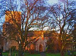
There has been a church in the village since the 13th century. The current chapel, however, dates from around 1406 when the church was renovated. The tower was added later. Hence, it is believed that the great fire of 1393 destroyed the old church. Dedicated to All Saints' Day , the building has a pulpit, a single nave with a porch to the south and a three-storey west tower.
Village community
The village is too small for anything other than the church. In 1960, resident TB Robinson even bought the former schoolhouse from the district administration and dedicated it as a village community center. This was named after him. The only inn Lolworth owned between 1760 and 1798 was The Three Horseshoes.
Lolworth is bordered by Bar Hill to the south, accessed by a dirt road. To the north is Swavesey , where most of the children go to school. Boxworth is west and Childerley is south.
Individual evidence
- ↑ 2001 census
- ^ A b c A History of the County of Cambridge and the Isle of Ely , Volume 9. Victoria County History, 1989, pp. 156-157.
- ↑ Recorded by Thomas Walsingham , a monk from St Albans in his Historica Anglicana
- ^ A b The Parish Church of All Saints, Lolworth . Archived from the original on July 26, 2011. Info: The archive link was automatically inserted and not yet checked. Please check the original and archive link according to the instructions and then remove this notice. Retrieved November 25, 2010.
- ^ AD Mills: A Dictionary of British Place-Names . 2003.
Coordinates: 52 ° 16 ' N , 0 ° 0' E

