Mill Island
| Mitterwohr | ||
|---|---|---|
|
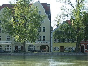
Isargestade street on the (Great) Isar |
||
| Waters | Isar | |
| Geographical location | 48 ° 32 '26 " N , 12 ° 9' 6" E | |
|
|
||
| length | 550 m | |
| width | 230 m | |
| surface | 16 ha | |
| main place | Between the bridges (district) | |
The Mühleninsel is an Isar island in Landshut , between the Isar on the right and the Kleine Isar on the left and between river kilometers 74.7 and 74.3. It is used as a local recreation area.
In addition to the green spaces with a view of the Isar, what is on offer includes an inn with a beer garden, a parking garage with a roof that is used as a sunbathing area and a Gothic barn. Landshut city center can be reached in less than five minutes via a wooden footbridge. The mill island can be seen as a green spot from the aerial photo.
The mill island belongs to the district 00 Altstadt . The district between the bridges is located on the island . The main thoroughfare is Zweibrückenstrasse, with the Seligenthaler bridge over the Kleine Isar and the Heilig-Geist-Brücke over the (Große) Isar.
Below the Mühleninsel lies the much larger Isar island Mitterwöhr , which is only separated from the Mühleninsel by the so-called mill piercing directly below the Johann-Weiß-Weg. The Gerlmühle is located in front of the confluence of the mill piercing into the small Isar. Above the mill island is 1.8 hectares large hammer island , by this leading separately through the partially hardly any water stream that runs directly above the Franz-Högner pathway. The three islands appear on the map as an elongated island between the two arms of the Isar, but are separated from each other by the narrow watercourses.
history
As the name suggests, the mill island has always been used as a special location for water mills . The upcoming construction of a required silo required that the overall situation in Landshut's inner city had to be reconsidered. Conservationists demanded that contemporary, usable historical building fabric be retained and that the mill island, due to its proximity to the city center, be used closer to the city center. It must be noted that the mill island with the local industry had an enormous amount of traffic and exhaust gas. Approx. 130,000 cubic meters of the building structure had to be demolished for the renovation. A Gothic barn (now occasionally used as a gallery) and an administration building, which is now used as a residential building, have been preserved. The newly added buildings include the Ludwigswehr hydropower station , a cycle path network, the multi-storey car park and the above-mentioned pedestrian bridge.
Web links
- Landshut Green Lung Mühleninsel (PDF file; 193 kB)
- Mühleninsel - a little story
literature
- Landshut green area (PDF file; 193 kB)
- Official website of the city of Landshut
- Alois Staudenraus: Topographical-statistical description of the city of Landshut in Bavaria and its surroundings ; Landshut 1835, 242 pages, in Google Books.

