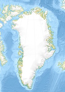
Munich Tinde
| Munich Tinde | ||
|---|---|---|
| height | 2557 m | |
| location | Scoresbyland , Greenland | |
| Mountains | Stauningalpen | |
| Coordinates | 71 ° 51 '11 " N , 25 ° 24' 1" W | |
|
|
||
| rock | granite | |
| First ascent | 1966 by Michl Anderl, Sepp Anzenberger, Gebhard Plangger, Karl Herrligkoffer | |
The Münchner Tinde is a 2557 meter high mountain in the Greenland Stauning Alps . It is located east of the upper part of the Spærre glacier above the Plinganser Col pass.
The mountain got its name from the "German Greenland Expedition to the Staunings-Alpen" under the direction of Karl Herrligkoffer , who climbed numerous mountains for the first time in 1966 and named them mainly after cities, towns and names. The first ascent of the Münchner Tinde was made by Michl Anderl, Sepp Anzenberger, Gebhard Plangger and Karl Herrligkoffer.
Web link
- Münchner Tinde on an interactive map, De Nationale Geologiske Undersøgelser for Danmark og Grønland (English)
Individual evidence
- ↑ Map of the Stauning Alps on a scale of 1: 150,000, De Nationale Geologiske Undersøgelser for Danmark og Grønland (GEUS). (PDF; 3.3 MB)
- ↑ Anthony K. Higgins: Exploration history and place names of northern East Greenland (= Geological Survey of Denmark and Greenland Bulletin 21, 2010), ISBN 978-87-7871-292-9 (PDF; 12.3 MB; English).
- ^ Horst Höfler , Reinhold Messner : Karl Maria Herrligkoffer. Obsessed, victorious, controversial. P. 282, AS, Zurich 2001, ISBN 3-905111-65-9 .
