Mała Czantoria
| Mała Czantoria | ||
|---|---|---|
|
View from Tuł |
||
| height | 866 m npm | |
| location | Silesia , Poland | |
| Mountains | Silesian Beskids | |
| Coordinates | 49 ° 41 '36 " N , 18 ° 46' 28" E | |
|
|
||

View from Tuł
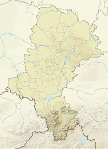
The Mała Czantoria (German: Kleine Czantoria ) is a mountain in Poland . It is located in the Ustroń municipality . With a height of 866 m, it is one of the lower mountains of the Czantoria ridge of the Silesian Beskids . The mountain is a popular tourist destination with many views of the neighboring mountains and the lowlands. During the Second World War, its wooded slopes were a refuge for partisans of the Ustroń unit. In November 1943 there was fighting between the partisans and the Wehrmacht. A memorial commemorates the fallen.
tourism
- Several marked hiking trails from Ustroń and Goleszów lead to the top .
- At the top there is the Mała Czantoria mountain hut , which is currently not in use.
literature
- Mirosław J. Barański: Beskid Śląski. Pasmo Stożka i Czantorii. Przewodnik turystyczny . Wyd. Wydawnictwo PTTK “Kraj”, Warszawa 1996, ISBN 83-7005-370-X
- Mirosław J. Barański, Beskid Śląski: Przewodnik. 2007. ISBN 978-83-89188-71-7 , Pruszków, Oficyna Wydawnicza “Rewasz”
Web links
Commons : Mała Czantoria - collection of images, videos and audio files

