Madison Range
| Madison Range | ||
|---|---|---|
| Highest peak | Hilgart Peak ( 3449 m ) | |
| location | Montana , United States | |
| part of | Rocky mountains | |
|
|
||
| Coordinates | 44 ° 55 ′ N , 111 ° 28 ′ W | |
|
Panoramic view of the southwest side |
||
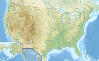
The Madison Range is a mountain range in the Rocky Mountains in Montana in the United States . The mountain range was named by Meriwether Lewis as part of the Lewis and Clark Expedition in 1805 in honor of the then future president, James Madison .
geography
The mountain range extends for 130 km (80 miles) from West Yellowstone to Bozeman and is bounded to the west by the Madison River and to the east by the Gallatin River . The highest peak of the range is Hilgard Peak with 3449 m, which was not climbed until 1948.
The Madison Range is the westernmost part of what is known as the Greater Yellowstone Ecosystem . Most of the mountain range lies within the Beaverhead-Deerlodge National Forest and the Gallatin National Forest . A small part of the mountain range was further protected with the establishment of the Lee Metcalf Wilderness . The region is home to grizzly and black bears and at least one pack of wolves . Most of the other larger mammal species native to the region still live in the mountains.
Not far south of the Hilgard Peak is Earthquake Lake . The lake was created by a landslide that dammed the Madison River after an earthquake in 1959.
Web links
- Madison Range in the United States Geological Survey's Geographic Names Information System
- Madison Range on Peakbagger.com (English)
Individual evidence
- ↑ Madison Range in the Geographic Names Information System of the United States Geological Survey
- ^ Hilgard Peak . Summit post. Retrieved September 10, 2008.
- ↑ US Geological Survey: Largest Earthquake in Montana . In: Historic Earthquakes . Archived from the original on June 8, 2007. Retrieved September 10, 2008.


