West Yellowstone
| West Yellowstone | |
|---|---|
 |
|
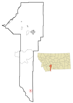
| Location in Montana | |
| Basic data | |
| Foundation : | 1909 |
| State : | United States |
| State : | Montana |
| County : | Gallatin County |
| Coordinates : | 44 ° 40 ′ N , 111 ° 6 ′ W |
| Time zone : | Central ( UTC − 6 / −5 ) |
| Residents : | 1,271 (as of 2010) |
| Population density : | 605.2 inhabitants per km 2 |
| Area : | 2.1 km 2 (approx. 1 mi 2 ) |
| Height : | 2031 m |
| Postal code : | 59758 |
| Area code : | +1 406 |
| FIPS : | 30-79525 |
| GNIS ID : | 793137 |
| Website : | www.townofwestyellowstone.com |
 West Yellowstone city center |
|
West Yellowstone is a small town (with the status of " Town ") in Gallatin County in the US -amerikanischen State Montana . In 2010 West Yellowstone had 1271 residents.
geography
West Yellowstone is located in southwest Montana and borders directly on Yellowstone National Park . The place is about three kilometers west of the Madison River , one of the two headwaters of the Missouri . The intersection of the three states of Montana, Idaho and Wyoming is around 20 km south-southeast of West Yellowstone.
The geographical coordinates of West Yellowstone are 44 ° 39'45 "north latitude and 111 ° 6'21" west longitude. The place extends over an area of 2.1 km².
Neighboring towns to West Yellowstone are Island Park in Idaho (45.3 km southwest) and Cameron (96.7 km northwest).
The closest major cities are Montana's largest city, Billings (344 km northeast), Utah's capital Salt Lake City (515 km south), and Idaho's capital Boise (623 km west).
traffic
US Highways 20 , 191 and 287 run through West Yellowstone on a common route from the east through Yellowstone National Park and split in the city center. The US 191 and US 287 branch off to the north on a common route, while the US 20 leaves the city in a westerly direction towards Idaho. All other roads are subordinate country roads, some unpaved roads and inner-city connecting roads.
With the Yellowstone Airport is located 4.3 kilometers north of the city a regional airport on the daily flights to Salt Lake City International Airport are made.
population
| Population development | |||
|---|---|---|---|
| Census | Residents | ± in% | |
| 1930 | 200 | - | |
| 1940 | 300 | 50% | |
| 1950 | 400 | 33.3% | |
| 1960 | 500 | 25% | |
| 1970 | 756 | 51.2% | |
| 1980 | 735 | -2.8% | |
| 1990 | 913 | 24.2% | |
| 2000 | 1177 | 28.9% | |
| 2010 | 1271 | 8th % | |
| 1930-2000 2010 | |||
According to the 2010 census , West Yellowstone had 1,271 people in 617 households. The population density was 605.2 people per square kilometer. Statistically, 2.06 people lived in each of the 617 households.
The racial the population was composed of 86.6 percent white, 0.4 percent African American, 1.1 percent Native American, 0.9 percent Asian and 7.5 percent from other ethnic groups; 3.5 percent were descended from two or more races. Regardless of ethnicity, 17.9 percent of the population was Hispanic or Latino of any race.
20.9 percent of the population were under 18 years old, 70.7 percent were between 18 and 64 and 8.4 percent were 65 years or older. 46.9 percent of the population were female.
The average annual income for a household was 45,147 USD . The per capita income was $ 24,463. 21.8 percent of the population lived below the poverty line.
Individual evidence
- ↑ a b c American Fact Finder. Retrieved July 17, 2014
- ↑ Distance information according to Google Maps. Accessed on July 17, 2014
- ↑ Yellowstone Airport.Retrieved July 17, 2014
- ↑ US Decennial Census.Retrieved July 17, 2014


