Mana (India)
| Mana | ||
|---|---|---|
| height | 7272 m | |
| location | Uttarakhand ( India ) | |
| Mountains | Kamet Group ( Garhwal Himalayas ) | |
| Dominance | 4.8 km → Kamet | |
| Notch height | 732 m | |
| Coordinates | 30 ° 52 '50 " N , 79 ° 36' 54" E | |
|
|
||
| First ascent | August 12, 1937 by Frank Smythe | |
| Normal way | glaciated alpine tour | |
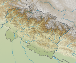
Mana (also Mana Peak ) is a 7272 m high mountain in the Himalayas in Uttarakhand , India . It is the southern neighbor of the 7,756 m high Kamet , from which it is separated by a 6540 m high saddle.
Ascent history
On August 11, 1937, the British mountaineers Frank Smythe and Peter Oliver - supported by Tse Tendrup, Ang Bao, Wangdi and Nurbu Sherpa - set up a small camp above the Banke Glacier. The next day, Smythe and Oliver set out for the summit. She first tried the ascent over the northwest ridge but had to break off due to poor conditions. Then Smythe and Oliver were able to reach the south ridge via the west wall and start a second attempt over it. Peter Oliver later had to break off the ascent due to the exhausting steps. Frank Smythe then completed the first ascent of Mana Peak alone. Six years earlier, Smythe was one of the first to climb the Kamet (7756 m), a few kilometers to the north.
literature
- Frank S. Smythe: The Valley of Flowers. 1949. Available online at www.archive.org, accessed October 26, 2011.
Web links
Individual evidence
- ^ Francis Sidney Smithe: The Mountain Vision. London 1941, pp. 233f. at www.archive.org, accessed October 26, 2011.
- ^ Francis Sidney Smithe: Valley Of Flowers , pp. 224ff. on www.archive.org.
