Manguéni plateau
| Manguéni plateau
Plateau de Manguéni
|
||
|---|---|---|
| location | Agadez region , Niger | |
|
|
||
| Coordinates | 22 ° 38 ′ N , 12 ° 36 ′ E | |
The Manguéni Plateau ( French : Plateau de Manguéni ) is a plateau in Niger .
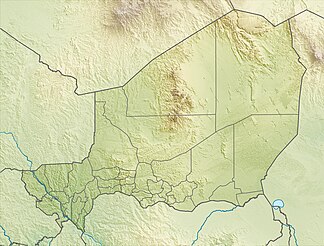
The Manguéni Plateau is located in the far north of Niger on the border with Algeria and Libya . At most of the edges it is bounded by a rugged terrain, only in the north it goes directly into the sandy desert of Murzuq . To the south, beyond the Achélouma dry valley , is the Djado plateau . Administratively, the Manguéni Plateau belongs to the rural municipality of Djado . It is a typical Sahara - Hammada with rocky soil and reaches a height of 1,054 m .
In terms of geological history, the Manguéni Plateau is part of the Paleozoic . Rock carvings from the cattle age testify to an earlier human settlement. The plateau has a long history as a border region, as a buffer zone between the spheres of influence of the Ottoman Empire with the Ghat in the north and the Sultanate of Kanem-Bornu in the south. Under Muammar al-Gaddafi , Libya repeatedly claimed the Manguéni Plateau. Because of its character as a no man's land , the border region is frequented by smugglers .
literature
- Jan Krause, Brigitta Schütt: Fluvial geomorphology and palaeohydrology of a small tributary of the Plateau de Mangueni, NE Niger . In: Roland Baumhauer , Jürgen Runge (Ed.): Holocene palaeoenvironmental history of the central Sahara (= Palaeoecology of Africa . No. 29 ). CRC, Boca Raton 2009, ISBN 0-415-48256-9 , pp. 137-157 .
- Manfred Raab: Representation and interpretation of the climatic conditions on the Mangueni Plateau (central Sahara) . Dissertation. University of Vienna, 1984.
Individual evidence
- ^ Marc Carlier: La "Drôle de Guerre" au Sahara. Confins nigériens 1938-1940 . Karthala, Paris 2006, ISBN 978-2-84586-847-2 , pp. 11 .
- ↑ Niger. (PDF) map. Ministère des Affaires étrangères et du Développement international, direction des Archives (pôle géographique), December 2014, accessed on June 15, 2017 (French).
- ↑ Thomas Krings : Sahel countries . WBG, Darmstadt 2006, ISBN 3-534-11860-X , p. 16 .
- ↑ Boubé Gado: Paléoenvironnements et occupation humaine des temps préhistoriques à l'époque contemporaine . In: Franck Giazzi (ed.): La Réserve Naturelle Nationale de l'Aïr et du Ténéré (Niger). The connaissance des éléments du milieu naturel et humain dans le cadre d'orientations pour un aménagement et une conservation durables. Analysis descriptive . Union Internationale pour la conservation de la nature et de ses ressources, Gland 1996, ISBN 2-8317-0249-6 , p. 263 .
- ^ Camille Lefebvre: Histoire des frontières du Niger . In: Matériaux pour l'histoire de notre temps . Vol. 73, No. 1 , 2004, p. 21 ( persee.fr [accessed June 15, 2017]).
- ↑ Rébellion au Niger: Kadhafi demande la reconnaissance du MNJ avant d'offrir sa médiation. In: Afribone. September 25, 2007, accessed June 15, 2017 (French).
- ^ Niger: combats entre l'armée et des narcotrafiquants dans le Ténéré. In: PressAfrik. September 6, 2013, accessed June 15, 2017 (French).
