Marsabit
| Marsabit | ||
|---|---|---|
 Marsabit |
||
| Basic data | ||
| county | Marsabit County | |
| Residents | 30,000 pop. | |
| Coordinates | 2 ° 20 ′ N , 37 ° 59 ′ E | |
|
|
||
| Marsabit | ||||||||||||||||||||||||||||||||||||||||||||||||
|---|---|---|---|---|---|---|---|---|---|---|---|---|---|---|---|---|---|---|---|---|---|---|---|---|---|---|---|---|---|---|---|---|---|---|---|---|---|---|---|---|---|---|---|---|---|---|---|---|
| Climate diagram | ||||||||||||||||||||||||||||||||||||||||||||||||
| ||||||||||||||||||||||||||||||||||||||||||||||||
Marsabit is the capital of Marsabit County in the rural and sparsely populated northern Kenya .
geography

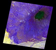
Marsabit is located on Mount Marsabit , a large island mountain of volcanic origin, which rises from the semi-desert at an altitude of around 400 m to a height of 1700 m. In contrast to the surroundings, the mountain is forested and suitable for agriculture.
history
Nothing is known about permanent settlements before 1900 on the site of today's location. The ethnic groups of the Rendille , Borana , Gabbra and Samburu who recently lived in the region lived as nomadic cattle breeders until around 1900, some of them only visited the area of today's Marsabit in the dry season or during drought. They knew the mountain by the name Saaku .
It was not until the beginning of the 20th century that the short-lived Boma Trading Company (1907–1909) and then the British colonial administration established a permanent presence on Mount Marsabit. When the Northern Frontier District , to which the Marsabit district then belonged, was placed under the military administration of the Kings African Rifles in 1921 , the district was temporarily renamed Gabra District after the Gabbra . In 1925 they returned to civilian administration. In 1931 there were 262 people living in the settlement, mainly police officers, administrative officials and some Indian and Somali business people. After 1931, farmers were recruited by the Burji and Konso from Moyale to grow food locally. With them, the number of inhabitants rose to 664 by 1935. The administration tried to avoid the settlement of members of the directly neighboring pastoral peoples in order to prevent overgrazing and overuse of the water resources. Rendille, Borana, and Gabbra were only welcome if they became farmers and only brought a certain number of animals. The name Marsabit is said to be derived from the Amharic marsa-beit , "house of marsa".
Demographics
The population of the Marsabit district was estimated at 10,399 in 1929, of which just 2% were resident in Marsabit. Despite the restrictive policy of the colonial government, 2038 people were already settled on Mount Marsabit in 1958, around 7% of the district's population. By 1969 - after Kenya gained independence - the population had tripled. In the 1960s around 10% of the district population lived on Mount Marsabit, in the 1970s this was 15%, in the 1980s 21% and in the 1990s it was still around 21%. This increase is related to droughts in the 1970s, which resulted in large livestock losses and prompted ranchers to settle. Furthermore, immigrants came from the northern neighboring country Ethiopia , who were also affected by the drought, political unrest and civil war. In some cases, humanitarian organizations supported the settlement of these people in villages. The completion of the road link from Nairobi to Addis Ababa further accelerated Marsabit's growth.
In 2005 around 30,000 people lived in Marsabit and the surrounding villages on the mountain. On the south side of the mountain mainly Rendille and Samburu live, on the north side a more heterogeneous population of Borana, Gabbra, Waata , Konso, Burji, Sakuye , Garre and Sidama live . Kenyans from other parts of the country are increasingly settling in the city, for example as employees of international organizations that provide development aid in the region. The mountain is partially protected as Marsabit National Park .
Picture gallery
literature
- Elliot M. Fratkin, Eric Abella Roth: As pastoralists settle: social, health, and economic consequences of the pastoral sedentarization in Marsabit District, Kenya , 2005, ISBN 9780306485947
Individual evidence
- ↑ Kenya Meteorological Department: Klimeinformationen Marsabit. World Meteorological Organization, accessed October 27, 2012 .
- ↑ a b c Paolo Tablino: The Gabra: camel nomads of northern Kenya , Paulines Publications Africa, Revised Edition 1999, ISBN 9789966214386 (p. 22)
- ↑ Günther Schlee : Identities on the move: clanship and pastoralism in northern Kenya , Manchester University Press 1989, ISBN 9780719030109 (pp. 112, 115f.)
- ↑ Tablino 1999 (p. 237)


