Masang Kang
| Masang Kang | ||
|---|---|---|
| height | 7194 m | |
| location | Gasa ( Bhutan ) | |
| Mountains | Himalayas | |
| Dominance | 15.96 km → Summit northwest of Tongshanjiabu | |
| Coordinates | 28 ° 10 '15 " N , 89 ° 46' 2" E | |
|
|
||
| First ascent | October 13, 1985 by Goro Hitomi , Toshihiro Tsukihara , Kotaro Yokoyama , Shigeki Nakayama | |
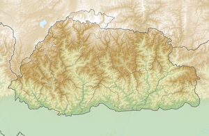
The Masang Kang (also Masa Gang ) is a mountain in the eastern Himalayas in northern Bhutan .
The 7194 m high glaciated mountain is located in the Jigme Dorji National Park . It is located 1.3 km south of the main Himalayan ridge, where the border with China runs. The Tsenda Kang ( 6481 m ) rises 11.5 km southeast . The Tongshanjiabu ( 7207 m ) is located 18.75 kilometers further east. The Masang Kang is located in the catchment area of the Mo Chhu .
A Japanese group of climbers from the Kyoto University Alpine Club made the first ascent in 1985 . Goro Hitomi , Toshihiro Tsukihara , Kotaro Yokoyama and Shigeki Nakayama reached the summit of Masang Kang on October 13, 1985. The ascent led from the north-eastern spur of the mountain over a pre-summit to the main summit. On October 14th, Kozo Matsubayashi, Hironori Ito, Shinya Takeda and Masanaru Takai followed, and on October 15th, Yasuhiko Kamizono, Hironori Ito, Koichi Nanno and Tadao Okada followed to the summit.
