
Masela (island)
| Masela | ||
|---|---|---|
 |
||
| Waters | Timor Sea | |
| Archipelago | Babar Islands | |
| Geographical location | 8 ° 9 ′ S , 129 ° 52 ′ E | |
|
||

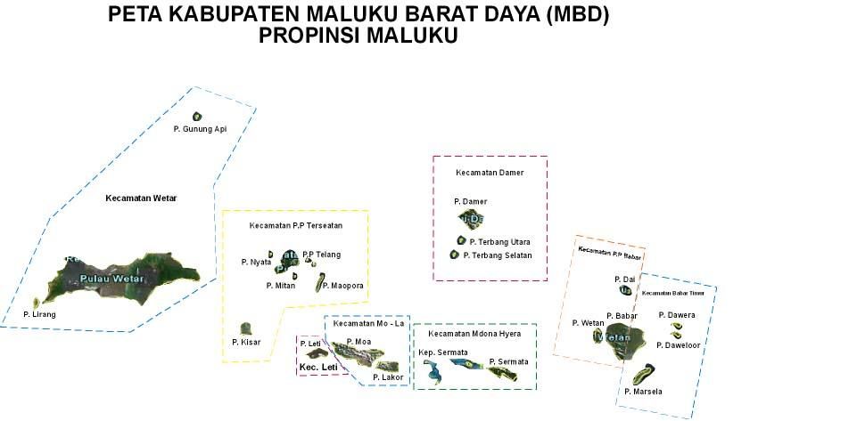
The Indonesian island of Masela (also Marsela , indon. Pulau Masela ) belongs to the Babar Islands of the southern Moluccas .
geography
Masela is located southeast of the main island of Babar . Together with its eastern part and the islands of Dawera and Daweloor in the northeast, Masela forms the sub-district ( Kecamatan ) Babar Timur ( administrative region of the southwestern Moluccas , Maluku province ).
Places on the island include Masela , Welulora , Ilbutung , Papilewan , Lawawang , Wawiotang and Telalora .
Residents
According to Ethnologue, the residents speak three related Austronesian languages : East , West , and Central Masela .
Individual evidence
- ^ Map of the Southwest Moluccas
- ^ Ethnologue: Masela-South Babar