Matakong
| Matakong | ||
|---|---|---|
| Waters | Atlantic Ocean | |
| Geographical location | 9 ° 16 ′ N , 13 ° 25 ′ W | |
|
|
||
| Highest elevation | 1 m | |
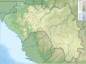
Matakong is an island in the Atlantic Ocean off the coast of Guinea , between the Guinea capital Conakry and the border with Sierra Leone . It is part of the Forécariah prefecture .
transport
The proposed Transguinean Railway is to end in Matakong . The railway will run from the iron ore deposits in the southeast and the bauxite deposits in the north to the port of Matakong.
A new deep water port is needed because the port at Conakry cannot be expanded any further and because Matakong, despite the shallower water, has better access to the hinterland.
Individual evidence
- ^ Travelingluck.com , Île Matakong, Forécariah, Guinea
- ↑ bellzone.com ( Memento of the original from December 7, 2011 in the Internet Archive ) Info: The archive link was inserted automatically and has not yet been checked. Please check the original and archive link according to the instructions and then remove this notice. , Port and Rail
