
Mengueme
| Mengueme | |||
|---|---|---|---|
|
|||
| Coordinates | 3 ° 15 ' N , 11 ° 24' E | ||
| Basic data | |||
| Country | Cameroon | ||
| Center | |||
| ISO 3166-2 | CM-CE | ||
| height | 665 m | ||
| surface | 548 km² | ||
| Residents | 7500 (2005) | ||
| density | 13.7 Ew. / km² | ||

Mengueme (or: Mangueme ) is a municipality in the Nyong-et-So'o district in the Center region in Cameroon and consists of 16 villages. As an educational location, the municipality is of supraregional importance.
geography
Mengueme is located in southwest Cameroon, about 50 kilometers south of the capital Yaoundé .
traffic
Two of Mengueme's villages are on the N2 . The confluence of the P8 provincial road into the N2 national road is in the municipality.
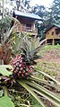
gallery

Bungalows in Ebogo
Bungalows

Nyong River

Nyong River

Kossipo millennial tree, Ebogo


Web links
- Mengueme at cvuc.cm