Menhir of Dannenfels
| Menhir of Dannenfels Menhir or Hünestaa | ||
|---|---|---|
|
|
||
| Coordinates | 49 ° 37 '48.3 " N , 7 ° 55' 58.2" E | |
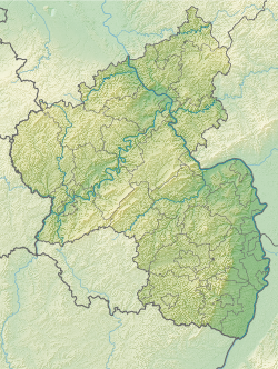
| place | Donnersberg , Dannenfels , Donnersbergkreis , Rhineland-Palatinate , Germany | |
The menhir of Dannenfels (also known as Hinkelstein or Hünestaa ) is a possible menhir on the eastern slope of the Donnersberg near Dannenfels in the Donnersbergkreis in Rhineland-Palatinate .
Location and description
The menhir is located in the forest about 500 m west of Dannenfels on the eastern slope of the Donnersberg in the so-called "Bear Hole". It is right on a forest path. A road passes about 50 m to the west. 600 m to the south-west is a Celtic ring wall system from the 2nd century BC. Chr.
The fallen menhir consists of locally occurring rock. It has a height of 150 cm, a width of 90 cm and a depth of 60 cm. It is prism-shaped and has a triangular cross-section. Ernst Christmann thought it possible that it originally came from the nearby ring wall. Since it shows no traces of processing, there is also the possibility, according to Johannes Groht, that it is just a natural stone that has detached itself from the adjacent rock.
literature
- Ernst Christmann: Menhirs and menhirs in the Palatinate. Speyer, n.J. (1947), pp. 21-22.
- Johannes Groht: Menhirs in Germany. State Office for Monument Preservation and Archeology Saxony-Anhalt, Halle (Saale) 2013, ISBN 978-3-943904-18-5 , p. 327.
- Horst Kirchner: The menhirs in Central Europe and the menhir thought. Academy of Sciences and Literature, Treatises of the Humanities and Social Sciences Class, born in 1955, No. 9, Wiesbaden 1955, p. 150.
Web links
Individual evidence
- ^ Johannes Groht: Menhirs in Germany. P. 327.
