Menhir of Kaiserslautern
| Menhir of Kaiserslautern Menhir from Bännjerrück | ||
|---|---|---|
|
|
||
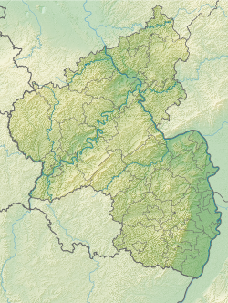
| Coordinates | 49 ° 25 '54.9 " N , 7 ° 43' 29.8" E | |
| place | Kaiserslautern , Rhineland-Palatinate , Germany | |
The menhir of Kaiserslautern (also known as the menhir of Bännjerrück ) is a menhir in Bännjerrück , a district of Kaiserslautern in Rhineland-Palatinate .
location
The stone is located in the western part of Bännjerrück, in the middle of a settlement that was built between 1950 and 1970. It stands in a green area and can be reached via a footpath that connects Leipziger Strasse and Hallesche Strasse. In 1947, bulges were found in the area around the stone, which perhaps were burial mounds . In the Middle Ages the menhir served as a boundary stone .
description
The menhir is made of red sandstone . It has a total height of 185 cm, of which 145 cm protrude from the ground. Its width is 84 cm, its depth 46 cm. The stone is columnar and has a round top. In the upper area the letters “B. St. "and the year" 1842 "as well as a frame carved.
literature
- Ernst Christmann: Menhirs and menhirs in the Palatinate. Speyer 1947, pp. 25-26.
- Otto Gödel: Menhirs. Witnesses of the cult, border and legal customs in the Palatinate, Rheinhessen and the Saar area. Speyer 1987, pp. 105-106.
- Johannes Groht : Menhirs in Germany. State Office for Monument Preservation and Archeology Saxony-Anhalt, Halle (Saale) 2013, ISBN 978-3-943904-18-5 , pp. 277, 334–335.
- Horst Kirchner: The menhirs in Central Europe and the menhir thought (= Academy of Sciences and Literature. Treatises of the humanities and social sciences class. Born 1955, No. 9). Wiesbaden 1955, p. 149.
Web links
- The Megalithic Portal: Hinkelstein Baennjerrueck
Individual evidence
- ^ Johannes Groht: Menhirs in Germany. P. 334.
