Menhir from Mainz-Laubenheim
| Menhir from Mainz-Laubenheim | ||
|---|---|---|
|
The menhir of Mainz-Laubenheim |
||
|
|
||
| Coordinates | 49 ° 56 '53.1 " N , 8 ° 19' 3.9" E | |
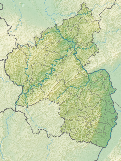
| place | Mainz-Laubenheim , Rhineland-Palatinate , Germany | |
The menhir of Mainz-Laubenheim is a menhir near Mainz-Laubenheim , a district of Mainz in Rhineland-Palatinate .
location
The stone was discovered in the 1870s between the Laubenheim meadows and the “Kuhweide”, a Hechtsheim enclave in the Ried , a silted-up arm of the Rhine . In earlier times the menhir was probably converted into a boundary stone . In 1971 he was transferred as part of the land consolidation. Today he is in a field south of Laubenheim. It can be reached via a dirt road and has an information board.
description
The menhir is made of limestone that is around 1,000 m to the west. It has a height of 270 cm, a width of 200 cm and a depth of 200 cm. The menhir is pillar-shaped and ends in a sloping point. Its surface is badly weathered.
literature
- Georg Durst: The monoliths of the province of Rheinhessen. In: Mainz magazine. Volume 33, 1928, p. 22.
- Johannes Groht : Menhirs in Germany. State Office for Monument Preservation and Archeology Saxony-Anhalt, Halle (Saale) 2013, ISBN 978-3-943904-18-5 , pp. 312, 336.
- Horst Kirchner: The menhirs in Central Europe and the menhir thought (= Academy of Sciences and Literature. Treatises of the humanities and social sciences class. Born 1955, No. 9). Wiesbaden 1955, p. 161.
Web links
- The Megalithic Portal: Laubenheimer Stein
Individual evidence
- ↑ a b Menhir of Laubenheim. The Megalith Portal, accessed on May 22, 2018 .
- ^ Johannes Groht: Menhirs in Germany. P. 336.

