
Western Cape Water Supply System

:
A - Theewaterskloof, B - Voëlvlei, C - Berg River, D - Wemmershoek, E - Steenbras Lower, F - Steenbras Upper.
Small dams:
G - Kleinplaats, H - Woodhead, I - Hely-Hutchinson, J - Land-en-Zeezicht, K - De Villiers, L - Lewis Gay, M - Victoria, N - Alexandra
The Western Cape Water Supply System , abbreviated to WCWSS (German roughly: "Water supply system of the Western Cape Province") is an infrastructure of the public services of general interest in South Africa in the Western Cape Province to supply cities and smaller communities with drinking water and agricultural irrigation systems. The WCWSS is a complex of dams , pipelines , tunnels , water treatment plants and pumped storage systems .
overview
The geographical coverage area of the WCWSS extends to the following regions:
- Cape Town (Administrative Unit City of Cape Town )
- some towns in the district parishes of Overberg , Cape Winelands and West Coast
- Irrigation systems along the Berg River , Eerste River (between Stellenbosch and Macassar ) and Sonderend River .
history
The region of today's Cape Town with its valleys in the adjoining, inland mountainous country forms the nucleus of the irrigation industry for today's South Africa, as this is also the historical starting point of European agricultural and settlement geographic activities. Since the first European settlement, the drying up of the Cape and South Africa as a whole has been lamented and discussed in the literature. Observations in this regard were reported in older travel reports, such as those by Campbell (1822), Moffat (1842), Anderson (1856) or Livingstone (1857). In the first two decades of the 20th century there were considerable drought years in the Cape region, which were occasionally interrupted by short periods of precipitation with devastating precipitation. Years of high annual rainfall followed. This chain of events caused a sharp increase in irrigation agriculture, especially in the populated areas of the Little Karoo . This development also caused a rethink among farmers, which resulted in a change in water use practices towards canal and furrow irrigation with the construction of large dams. The intended goal was to secure a year-round or multi-year water supply base for the farm areas.
The Drought Investigation Commission (1922–23) and further work by TEW Schumann with WR Thomson (1934) and by B. de Loor (1948) have dealt in depth with the precipitation conditions and their effects, without relating them to climate change . On the other hand, anthropogenic influences on the reduced precipitation effects received widespread attention in research up into the 20th century. In the second half of the 20th century, there was increasing public awareness that disruptive influences, such as harmful farming methods and frequent, devastating periods of drought, had influenced agricultural conditions more than previously assumed. Interestingly, C. E. Tidmarsh (1948) and Kurt Kayser (1957) stated that the “climatic deterioration” caused by humans has a macroclimatic effect.
Around 1946 the water supply of the Cape was determined by small-scale systems, the focus of which was on a large number of boreholes ( 1946 : 10,350; 1962 : approx. 12,000), of which 4,775 were equipped with wind turbines for the purpose of extraction. There were also around 19,000 smaller surface water reservoirs in natural depressions. There, the users dammed the water from springs and precipitation by means of earth dams. In many areas, the expenses for building larger dams were hampered by the high evaporation rate as well as the considerable debris flow and suspended matter in the watercourses. On the other hand, the well drilling offered an advantageous alternative due to a largely stable water supply of high quality.
With the increasing demand for water due to economic and demographic development, in 1956 the previously applicable water law was adapted. As a result, it became easier to carry out large-scale planning for the needs of water management systems. This resulted, for example, in the Great Berg River and Saldanha Bay Water Supply Scheme including the Wemmershoek Dam and the Vogelvlei Water Conservation Scheme (today Berg Water Management Area ), two water abstraction and protection systems with a fundamental future impact for the Western Cape region.
Until 1897, Cape Town's water supply consisted only of extraction points at natural springs , the disadvantage of which was that the spring discharge was subject to seasonal fluctuations. The first drinking water dam built for Cape Town was Woodhead Dam on Table Mountain , which was commissioned in 1897.
Components
The main reservoirs are 6 dams:
- Berg River Dam on the Berg River (capacity: 130,010 megaliters - million liters ),
- went into operation in 2009. There was a previous building, which started operations in 1897 and was called Skuifraam Dam . Administration is carried out by the City of Cape Town .
- Steenbras Dam-Lower on the Steenbras River (capacity: 33,517 megalitres),
- started operation in 1921. It was created by Cape Town and other communities and therefore later fell into the administration of the Greater Cape Town Municipality .
- Steenbras Dam-Upper on the Steenbras River (capacity: 31,767 megalitres),
- Commissioned in 1977 and is operated by the City of Cape Town . This is where the Steenbras pumped storage scheme is located , which generates electrical energy and delivers it to the national grid.
- Theewaterskloof Dam on the Sonderend River (capacity: 480,188 megalitres),
- This dam is by far the largest water reservoir in the WCWSS and receives its water from numerous tributaries in the vicinity. In addition, water is fed to it from the Berg River Dam , as the Berg River has a high water level at times. An extensive tunnel system with a total length of more than 30 kilometers guides water through the Franschhoek, Groot Drakenstein and Stellenbosch mountains via the Kleinplaas Balancing Dam as a temporary storage facility to Cape Town.
- Voëlvlei Dam on the Voelvlei River (capacity: 164,095 megalitres),
- Commissioned in 1971 and operated by the Department of Water and Sanitation .
- Wemmershoek Dam on the Wemmers River (capacity: 58,644 megalitres),
- Commissioned in 1957 and is operated by the City of Cape Town .
- Misverstand Weir , a discharge weir on the lower reaches of the Berg River near Piketberg to supply agricultural irrigation areas in the vicinity of Vredenburg and Saldanha . There is a water supply to the Withoogte water treatment system .
Other, smaller water reserves are:
In the area of Table Mountain :
- Woodhead Dam (1893-1897),
- Hely Hutchinson Dam ,
- Victoria Dam ,
- Alexandra Dam ,
- De Villiers Dam .
Lying at Simon's Town :
- Kleinplaats Dam ,
- Lewis Gay Dam .
Both reservoirs originally only served to supply Simon's Town, but were connected to the Cape Town water supply system in 1997 as part of a regional administrative reform.
gallery

De Villiers Dam (Table Mountain)

Hely Hutchinson Dam (Table Mountain)

Woodhead Dam (Table Mountain)

Berg River Dam
Theewaterskloof Dam

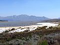
Voëlvlei Dam

Steenbras Dam


.jpg)


Web links
- City of Cape Town: Residential water and sanitation services . on www.capetown.gov.za (English)
- Republic of South Africa. Department of Water and Sanitation: Western Cape Drought Situation: Portfolio Committee on Water and Sanitation Briefing 25 October 2017 . (As of October 25, 2017) on www.pmg.org.za (English)
Individual evidence
- ↑ Traugott Molter: Water balance and irrigation agriculture in the Cape . Franz Steiner Verlag, Wiesbaden 1966, p. 156
- ^ National Library of Australia: bibliographic evidence . on www.nla.gov.au
- ^ National Library of Australia: bibliographic evidence . on www.nla.gov.au
- ^ National Library of Australia: bibliographic evidence . on www.nla.gov.au
- ^ National Library of Australia: bibliographic evidence . on www.nla.gov.au
- ^ Molter: water balance . 1966, p. 152
- ^ University of the Witwatersrand: bibliographic evidence . on www.libguides.wits.ac.za
- ^ GVK: bibliographical evidence .
- ^ Molter: water balance . 1966, pp. 66-67
- ^ Molter: water balance . 1966, p. 76
- ^ Molter: water balance . 1966, p. 157
- ^ Republic of South Africa. Department of Water Affairs and Forestry: Berg Water Management Area . at www.dwaf.gov.za (PDF, English)
- ↑ a b c d e f g h i Brendon Feun: Cape Town Dams . on www.capewaterharvest.co.za (English)
- ^ Republic of South Africa. Department of Water and Sanitation: Cape Town River System State of Dams on 2018-05-14 . on www.dwa.gov.za (English)
- ↑ City of Cape Town: Dam levels . on www.capetown.gov.za (English)
- ^ Western Cape Reconciliation Strategy: G7. A new dam at misunderstanding. Scheme Description . 2005, online at www.dwaf.gov.za (PDF document p. 21, English)
- ^ Artefacts.co.za: Woodhead Reservoir . on www.artefacts.co.za (English)