Overberg (district)
| Overberg Overberg District Municipality |
||
|---|---|---|
 |
||
| Symbols | ||
|
||
| Basic data | ||
| Country | South Africa | |
| province | Western cape | |
| Seat | Bredasdorp | |
| surface | 12,241 km² | |
| Residents | 258,176 (October 2011) | |
| density | 21 inhabitants per km² | |
| key | DC3 | |
| ISO 3166-2 | ZA toilet | |
| Website | www.overberg.co.za (English) | |
| politics | ||
| mayor | A. Franconia | |
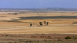
| Landscape in the Overberg district | ||
Coordinates: 34 ° 30 ′ S , 20 ° 4 ′ E
Overberg ( Overberg District Municipality , Afrikaans Overberg-distriksmunisipaliteit ) is a district within the Western Cape Province in South Africa . It has 258,176 inhabitants (as of October 2011) on a total area of 12,241 km². The district administration is based in Bredasdorp .
Overberg means roughly "behind the mountain". It is located in the east of Cape Town , "behind" the mountain range of the Hottentots-Holland Mountains (mountain range of the Cape Fold Belt ), which demarcate the Cape Peninsula from the eastern hinterland. It covers the area from Grabouw in the west via Riviersonderend to Barrydale in the northeast (around 200 kilometers) and from Genadendal in the north to Cape Agulhas in the south (around 120 kilometers).
The district is divided into the following municipalities:
- Theewaterskloof
- Swellendam
- Overstrand
- Cape Agulhas
- Overberg DMA (until 2011)
Neighboring districts are:
economy
Agriculture is characterized by grain fields, meadows and orchards. Wine is grown in several communities .
tourism
The Atlantic coast is well developed for tourism; numerous seaside resorts attract those seeking relaxation. In the southeast of the district is the De Hoop Nature Reserve . It was set up in 1957 and is known for its diverse flora and fauna. There is a colony of the rare Cape Vultures here . Right whales can be seen offshore as they mate and raise their young.
National parks and nature reserves
| Bontebok National Park | |
| Babilonstoring Nature Reserve | 778 ha |
| Botrivier Nature Reserve | 273 ha |
| Caledon Nature Reserve | 261 ha |
| De Hoop Nature Reserve | 32,278 ha |
| De Mond Nature Reserve | 927 ha |
| Fernkloof Nature Reserve | 1,379 ha |
| Greyton Nature Reserve | 2,069 ha |
| Groenlandberg Nature Reserve | 5,121 ha |
| Grootvaderbosch Nature Reserve | 250 ha |
| Heuningberg Nature Reserve | 904 ha |
| Hottentots-Holland Nature Reserve | 27,037 ha |
| Houwhoek Nature Reserve | 3,257 ha |
| Kleinmond Coast & Mountain Nature Reserve | 671 ha |
| Kogelberg Nature Reserve | 19,407 ha |
| Maanschynkop Nature Reserve | 784 ha |
| Marloth Nature Reserve | 11,237 ha |
| Mt Hebron Nature Reserve | 756 ha |
| Pearly Beach Nature Reserve | 630 ha |
| Quoin Point Nature Reserve | 1,149 ha |
| Riviersonderend Nature Reserve | 25,009 ha |
| Salmonsdam Nature Reserve | 839 ha |
| Soetendalsvlei Nature Reserve | 414 ha |
| Soetfontein Nature Reserve | 54 ha |
| Theewaters Nature Reserve | 14,182 ha |
| Uilkraalsmond Nature Reserve | 805 ha |
| Villiersdorp Nature Reserve | 530 hectares |
| Waenhuiskrans Nature Reserve | 266 ha |
| Walkerbay Nature Reserve | 3,586 ha |
| Warmwaterberg Nature Reserve | 2,693 ha |
| Zuurberg Nature Reserve | 1,232 ha |
languages
Web links
- Official website of the district administration (English)
- Portrait at localgovernment.co.za (English)
Individual evidence
- ^ Census 2011. Basic Results. (PDF; 349 kB) Statistics South Africa , accessed on November 27, 2015 (English).
- ^ Municipal Demarcation Board
- ↑ CapeGateway ( Memento of the original from September 27, 2007 in the Internet Archive ) Info: The archive link was inserted automatically and has not yet been checked. Please check the original and archive link according to the instructions and then remove this notice. (PDF; 21 kB)

