Middle Andaman Island
| Middle Andaman Island | ||
|---|---|---|
| Waters | Indian Ocean | |
| Archipelago | Andaman Islands | |
| Geographical location | 13 ° 30 ′ N , 92 ° 50 ′ E | |
|
|
||
| length | 68 km | |
| width | 31 km | |
| surface | 1 535.5 km² | |
| Highest elevation | Mount Diavolo 512 m |
|
| Residents | 54,385 (2001) 35 inhabitants / km² |
|
| main place | Rangat | |
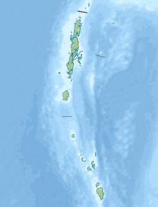
| Location of Middle Andaman Island | ||
Middle Andaman or Engl. Middle Andaman Island is the largest of the three main Andaman Islands in the Indian Ocean . Politically, the island belongs to the Indian Andaman and Nicobar Union territory .
geography
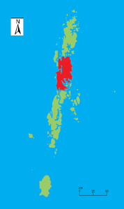
Middle Andaman Island is located in the center of the archipelago between North Andaman Island and Baratang , from which it is only separated by a strait that is only a few hundred meters wide. Middle Andaman Island is 68 km long, up to 31 km wide and has an area of almost 1536 km², which makes it the largest island of both the Andamans and all of India. The island reaches a height of 512 meters near the east coast in Mount Diavolo. The largest city on the island is Rangat . Other important places are Mayabunder, Billiground, Kadamtala, Bakultata and Betapur. As of the 2001 census, the island had a total of 54,385 inhabitants.
population
A few hundred Jarawa still live on the west coast of Middle Andaman , an indigenous Andaman ethnic group who speak a language from the group of Andaman languages , also called Jarawa . Nowadays no one of the also indigenous people of the Great Andamanese , for example the Bo , lives in Middle Andaman. The vast majority of the population are therefore mainly ethnic groups who have immigrated from the Indian mainland and their descendants.
fauna
On Middle Andaman Island the Indochinese wood rat ( Rattus andamanensis ), the Andaman rat ( Rattus stoicus ) and the Andaman shrew ( Crocudira hispida ) occur.
Individual evidence
- ↑ Island-wise Statistical Outline - 2008. MIDDLE ANDAMAN ISLAND ( page no longer available , search in web archives ) Info: The link was automatically marked as defective. Please check the link according to the instructions and then remove this notice. (PDF; English)
- ^ National Geospatial Intelligence Agency: PUB. 173, Sailing Directions (Enroute): India and the Bay of Bengal, Bethesda, Maryland, Ninth Edition (PDF; 4.0 MB), p. 247
- ↑ Directorate of Economics and Statistics, Andaman and Nicobar Administration, Port Blair: Statistical Hand Book on Andaman District & Nicobar District 2005-2006 ( Memento of the original of April 10, 2009 in the Internet Archive ) Info: The archive link was automatically inserted and not yet checked. Please check the original and archive link according to the instructions and then remove this notice. Table - 1.8 Tahsil-wise / Island-wise Population of Inhabited Islands (2001 Census) (PDF; English) (sum of 23894 from Tahsil Mayabunder and 30491 from Tahsil Rangat).

