Monroe Island
| Monroe Island | ||
|---|---|---|
| Map of the South Orkney Islands with Monroe Island | ||
| Waters | Southern ocean | |
| Archipelago | Larsen Islands , South Orkney Islands | |
| Geographical location | 60 ° 36 ′ 0 ″ S , 46 ° 3 ′ 0 ″ W | |
|
|
||
| length | 3 km | |
| width | 1.5 km | |
| surface | 2 km² | |
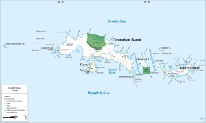
Monroe Island is the largest of the Larsen Islands in the South Orkney Archipelago . It is located off the western end of Coronation Island , separated by Sandefjord Bay .
The whaling captains George Powell and Nathaniel Palmer discovered the Larsen Islands in December 1821, but it was only their Norwegian counterpart Petter Sørlle who named the group after mapping between 1912 and 1913. In 1933, participants in the British Discovery Investigations retained Sørlle's name and named the largest of the islands as Larsen Island . The UK Antarctic Place-Names Committee found this too confusing in 1954 and renamed it. The namesake is now the sloop James Monroe , with which Nathaniel Palmer operated in 1821 in the waters around the southern Orkney Islands.
Web links
- Monroe Iceland in the Geographic Names Information System of the United States Geological Survey (English)
- Monroe Island on geographic.org (English)

