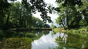
Montjola pond
| Montjola pond | ||
|---|---|---|

|
||
| Montjola pond | ||
| Geographical location | Vorarlberg , Austria | |
| Tributaries | Schwarzbach, Schlosstobel | |
| Drain | Drain into the Ill | |
| Location close to the shore | Thuringia | |
| Data | ||
| Coordinates | 47 ° 12 '16.2 " N , 9 ° 46' 1.5" E | |
|
|
||
| Altitude above sea level | 686 m above sea level A. | |
| length | 217 m | |
| width | 69 m | |
|
particularities |
Consists of several parts |
|
The Montjola-Weiher (also: Montjola-See or Montiola-Weiher, 686 m above sea level ) are located on the Quadern plateau in the municipality of Thuringia in Vorarlberg , Austria .
history
The Montjola ponds were laid out in 1837 for the operation of the spinning and weaving mill founded by John Douglass and partners . The ponds were dredged in the 1980s.
In 2016, the Montjola-Weiher II was renovated and redesigned for around 250,000 euros and the infrastructure slightly expanded. At the same time, a "historical adventure and educational trail" was set up, in which the long history of the use of hydropower for industry in Thuringia is illustrated. A significant part of the costs was funded by the European Union's LEADER program of measures .
Geography / topography
The Montjola ponds are about 400 m north of the center of Thuringia. The ponds are primarily fed by and flowed through by the Schwarzbach. From the Schlosstobel (brook) there is another approx. 1.1 km long water passage. The runoff takes place via the Montjola waterfall (Schwarzbach) and a pressure pipe into the Schwarzbach power plant .
The ponds are at the northern end of the populated area of Thuringia. It is around 15 km as the crow flies to the city center of Feldkirch and around 35 km to Lake Constance .
use
The Montjola ponds were created in Thuringia in 1837 for the use of water power for the textile industry. In addition, the Montjola ponds have been a popular excursion destination and local recreation area since then.
Web links
- Montiola Weiher Thuringia (youtube)
Individual evidence
- ↑ The Quadern plateau was formed by a meltwater flow to the side of the Ice Age Ill glacier. See: Ways to Water , Vorarlberg Tourism.
- ↑ a b Bi üs do z'Thürig ( page no longer available , search in web archives ) Info: The link was automatically marked as defective. Please check the link according to the instructions and then remove this notice. , Communication from the municipality of Thuringia, annual review 2016.
- ↑ Montjola Weiher shines in new splendor , vol.at, June 28, 2016 and Montjola Weiher redesigned , website of the municipality of Thuringia.
- ↑ Bi üs do z'Thürig , communication from the Thuringia municipality, 05/2016.
