
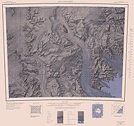
Mountaineer Range
| Mountaineer Range | ||
|---|---|---|
| location | Victoria Land , East Antarctica | |
| part of | Transantarctic Mountains | |
|
||
| Coordinates | 73 ° 28 ′ S , 166 ° 15 ′ E | |

The Mountaineer Range is a mountain range between the Mariner and Aviator glaciers in northern Victoria Land .
It was first seen in 1841 by the British navigator James Clark Ross during his Antarctic expedition (1839–1843). The complete mapping was carried out using aerial photographs by the United States Navy and survey work by New Zealand and American expedition teams in the 1950s and 1960s. The range was named in a campaign that lasted from 1958 to 1959 as part of the New Zealand Geological Survey Antarctic Expedition in memory of the mountaineering background of its participants who carried out field research in this area.
Web links
Commons : Mountaineer Range - collection of images, videos and audio files
- Mountaineer Range in the Geographic Names Information System of the United States Geological Survey (English)
- Mountaineer Range on geographic.org (English)
West part of the Mountaineer Range center right

Eastern part of the Mountaineer Range center left

