Murrumbidgee Shire
| Shire of Murrumbidgee | |
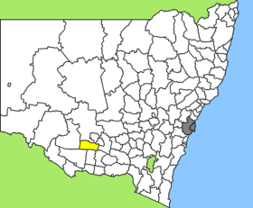
 Location of the Murrumbidgee Shire in New South Wales |
|
| structure | |
| State : |
|
| State : |
|
| Administrative headquarters: | Darlington Point |
| Dates and numbers | |
| Area : | 3,505 km² |
| Residents : | 2,261 (2011) |
| Population density : | 0.6 inhabitants per km² |
| Wards : | 3 |
Coordinates: 34 ° 48 ′ S , 145 ° 53 ′ E Murrumbidgee Shire was a local government area (LGA) in the Australian state of New South Wales . The area was 3,505 km² and last had about 2,500 inhabitants. In 2016 it went up in the Murrumbidgee Council .
Murrumbidgee was centrally located in the south of the state south of the Murrumbidgee River about 400 km west of the Australian capital Canberra and 420 km north of Melbourne . The area comprised 12 hamlets and hamlets: Clifford Downs, Coleambally, Cooinbil, Dirrung, Ercildoune, Gum Creek, Toganmain, Tubbo, Uri East, and Waddi as well as parts of Darlington Point and Four Corners. The headquarters of the Shire Council was in Darlington Point in the northeast of the LGA, which nowadays about 900 residents live.
administration
The Murrumbidgee Shire Council had eight members elected by residents of the two wards (four each from East and West Ward). These two districts were defined independently of the localities. The mayor of the council was also recruited from among the councilors.
Web links
Individual evidence
- ↑ a b Australian Bureau of Statistics : Murrumbidgee (A) (Local Government Area) ( English ) In: 2011 Census QuickStats . March 28, 2013. Retrieved April 14, 2014.
- ↑ Australian Bureau of Statistics : Darlington Point (L) ( English ) In: 2016 Census QuickStats . June 27, 2017. Accessed May 10, 2020.