Murum dam
| Murum dam | |||||||
|---|---|---|---|---|---|---|---|
|
|||||||
|
|
|||||||
| Coordinates | 2 ° 38 '57 " N , 114 ° 22' 6" E | ||||||
| Data on the structure | |||||||
| Construction time: | 2008-2013 | ||||||
| Height above foundation level : | 146 m | ||||||
| Height of the structure crown: | 542.5 m | ||||||
| Crown length: | 473 m | ||||||
| Power plant output: | 944 MW | ||||||
| Data on the reservoir | |||||||
| Water surface | 245 km² | ||||||
| Storage space | 5.475 million m³ | ||||||
| Total storage space : | 12.043 million m³ | ||||||
| Catchment area | 2,750 km² | ||||||
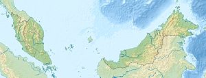
The Murum Dam is an RCC - gravity dam in Sarawak , the Malaysian part of the island of Borneo . The associated power plant has 4 Francis turbines with an output of 236 MW each.
Construction began in 2008 and damming began in July 2013. The generators were installed from late 2014 to June 2015.
See also
Individual evidence
- ↑ a b c Wang Si-ying, Hou Dong-mei, Wang Cai-huan: Aerator of stepped chute in Murum Hydropower Station . In: Procedia Engineering . tape January 28 , 2012, p. 803-807 , doi : 10.1016 / j.proeng.2012.01.813 ( PDF ).
- ↑ a b c d e Hydroelectric Power Dams in Sarawak ( Memento of the original from July 3, 2012 in the Internet Archive ) Info: The archive link was inserted automatically and has not yet been checked. Please check the original and archive link according to the instructions and then remove this notice.

