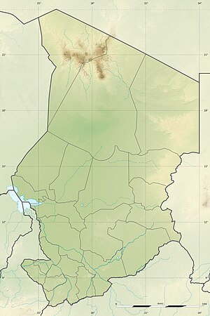
Lake N'gara
| Lake N'gara | ||
|---|---|---|
| Geographical location | Mayo-Kebbi Est region , Chad | |
| Tributaries | Mayo Kebbi | |
| Drain | Mayo Kebbi | |
| Data | ||
| Coordinates | 9 ° 55 '0 " N , 14 ° 44' 0" E | |
|
|
||
| Altitude above sea level | 319 m | |
Lake N'gara is a lake in the Mayo-Kebbi Est Region and Mayo-Kebbi Ouest Region , in the southwest of the Republic of Chad . It is located in the Toupouri lowland at an altitude of 319 to 323 meters above sea level and is irrigated and drained by the Mayo Kébbi river over an extensive wetland area . The Toupouri Depression was placed under the protection of the Ramsar Convention by Chad under the title Plaines d'inondation du Logone et les dépressions Toupouri . The size of the lake changes with the seasons and varies from 40 to 142 km². The lowest water level of four meters is reached in May / June, the highest level during the rainy season of the West African monsoons in September / October. The then drying lake basin is used intensively by the local population to grow rice. The lake floor is surrounded by gallery forests , which are classified as secondary forests due to their intensive use . The forests are mainly composed of the tree species Acacia albida , Acacia seyal and other wetland species such as Khaya senegalensis .
Individual evidence
- ↑ Country information Chad on Ramsar Wetland ( Memento from September 24, 2012 in the Internet Archive ) (PDF document) (English)
