Nasu-dake
| Nasu-dake
那 須 岳
|
||
|---|---|---|
| height | 1916.9 m TP | |
| location | Tochigi Prefecture , Japan | |
| Mountains | Ōu Mountains | |
| Coordinates | 37 ° 7 '29 " N , 139 ° 57' 46" E | |
|
|
||
| Type | Complex volcano | |
| Last eruption | November 1963 | |
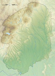
The Nasu-dake ( Japanese 那 須 岳 ) are a group of complex volcanoes in Japan . The Sanbon'yari is the highest peak in the group with a height of 1916.9 m. The group is located in the north of the Nikko National Park in Tochigi Prefecture , near the border with Fukushima Prefecture .
eruption
It began to erupt probably 600,000 years ago. The eruption started in the north at the Kashi-Asahi peak. Currently only the Chausu is active.
Main summit

SRTM -1 height profile
![]() Map with all coordinates: OSM | WikiMap
Map with all coordinates: OSM | WikiMap
- Sanbon'yari-dake ( 三本槍岳 ), 1916.9 m, 37 ° 9 ' N , 139 ° 58' O
- Chausu-dake ( 茶 臼 岳 ), 1915 m, 37 ° 7 ′ N , 139 ° 58 ′ E
- Asahi-dake ( 朝日 岳 ), 1896 m, 37 ° 8 ′ N , 139 ° 58 ′ E
- Minamigatsusan ( 南月山 ), 1775.7 m, 37 ° 7 ' N , 139 ° 57' O
- Kurooya-dake ( 黒 尾 谷 岳 ), 1589 m, 37 ° 6 ′ N , 139 ° 58 ′ E
These are also called the "Five Nasu Peaks" ( 那 須 五岳 , Nasu godake ).
Web links
Commons : Mount Nasu - collection of images, videos and audio files
- Nasudake - Kishō-chō ( yes )
- Nasudake: National catalog of the active volcanoes in Japan - Japan Meteorological Agency ( en )
- Nasudake - Geological Survey of Japan
- Nasudake: Global Volcanism Program - Smithsonian Institution

