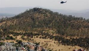
Cerro de la Estrella National Park
|
Cerro de la Estrella National Park
|
||
|
Vista Cerro de la estrella (2012) |
||
| location | Mexico City , Mexico | |
| surface | 200 ha | |
| WDPA ID | 306783 | |
| Geographical location | 19 ° 21 ' N , 99 ° 5' W | |
|
|
||
| Sea level | from 2290 m to 2435 m | |
| Setup date | August 24, 1938 | |
The National Park Cerro de la Estrella is located on the mountain Cerro de la Estrella in the district of Iztapalapa of Mexico City . Today the national park has more of the character of an urban park.
The park was originally set up with 1100 hectares in 1938 and is still managed in this size by the IUCN today . Due to the growing city and the resulting development, the park came under pressure, so that today it still has an area of less than 200 hectares . The protection goal was to protect the mountain Cerro de la Estrella and to preserve the cultural and archaeological fragments from the Teotihuacan culture.
Web links
Commons : Cerro de la Estrella National Park - Collection of images, videos and audio files
Individual evidence
- ↑ DEMOS, Desarrollo de Medios, SA de CV: La Jornada: Invasión de paracaidistas pone en riesgo valiosos bienes culturales, denuncian. Retrieved July 14, 2017 .
- ↑ Cerro de La Estrella | Protected Planet. Retrieved July 14, 2017 .

